Friday, December 30, 2011

Auckland Transit by Alan Hoffman

These slides were shared with me by Alan Hoffman of Mission Group, USA, at a conference on public transport held in Sydney in 2002. I was there to talk about the design of the Northern Busway, as Chair of North Shore City Council's Works and Environment Ctte. Alan's presentation is as relevant to Auckland's situation today as it was then. He begins with the age old questions which have been asked repeatedly in Auckland....

He notes the classic "is it about fare prices or is it about time saving" question. We have the same question in Auckland. We have the same outcome as US - especially when it comes to bus transit that's not on the busway. It's generally regarded as a poor service for people on low incomes.

He makes simple points about market research which echo much of what has been found in Auckland. We are easily able to capture the patronage of the proportion of Aucklanders who "prefer to use public transport". The trick is the next tranche. What needs to happen for them to take public transport?

The big thing is time saving. He makes the huge point that "you have to want to save their trip times". That means the service provider has to be committed to saving travel times by building public transport services that are faster, and more reliable, than travelling by car. And the "how" is by increasing the number of direct, express services. We have some of these in the Northern Busway. We need more in other parts of the bus network.


This slide is a development of the same point. It is about making public transport indispensable. But that's not necessarily for absolutely everybody in Auckland. It is built up by targeting areas and targeting geographies.


This slide emphasises the need for connectivity. That was a key factor in my approach to straightening Auckland bus routes.  

These next two slides reflect Auckland's current land use and public transport planning strategy....

.... and emphasise the goal of making a network that is useful...

I was lucky to go with the Parliamentary Commissioner for Environment's study trip to Curitiba almost 10 years ago. It is an extraordinary exemplar, and one which is cited by Alan in this slide. You can read here what Curitiba's goal was - an unattainable goal a bit like Auckland's sometimes appears to be. So Curitiba responded by doing what it could. Step by step. Auckland needs to do the same. Existing radial bus services need to be reorganised into a high frequency network which connects Auckland's towns, and cross-town orbital or direct connections can follow.

Parnell to Museum = Steep Walk

If you follow this blog you may have noticed some grumpy postings about the location currently proposed by Auckland Council for a railway station at Parnell. These include: Parnell Pet Project Politics, Parnell Station - Shakespearean Tragedy, Parnell Station - Poor Process Continues.

A big part of the justification cited for the location is that it affords easy access to the Museum, despite the fact the location is in the cleft of a steep gully. As this sequence of images illustrates. To the left is a walk many of you may have taken in the heart of Auckland. It's from Kitchener Street (top of Victoria), up a paved walkway and steps, to the flagpole on Albert Park. From A to B. You can check the physical elevations of these points using Google Earth. The elevation of A is 99 feet, while that of B is 131 feet, which indicates you climb 32 feet vertically in that walk. Which I know leaves people I know puffed taking this walk on the way to Maidment Theatre from the car park.

This aerial shows a walk I take quite a bit when I'm walking to University from the ferry. From Custom St East, up Emily Place, through Emily Park to the bottom of Princes Street, and then up to Waterloo Quadrant, and so on. The elevations are as follows: A is 39 feet, B is 69 feet, c is 97 feet, and D is 131 feet. I get a bit puffed doing this walk briskly - and I'm cycling fit. Do the math and you see that the vertical climb, from A to D is 92 feet.
This shows the proposed location for Parnell Station (Point A), and a possible route up to the Museum. As far as I know, no budget has yet been allocated for this path and/or steps. It needs to go through some native bush. The elevation of proposed Parnell Station is 62 feet. The elevation of Point B is 163 feet, of Point C is 191 feet, and a slight incline from there up to the museum at Point D at 200 feet.

The whole climb is 138 feet, and there is very steep climb out of the gully of more than 100 feet. This might be a walk in the park for some - but it does not constitute easy and convenient access to the museum. It certainly does not justify building a railway station at this location.

Wednesday, December 21, 2011

Public Interest and Queens Wharf

Just wanted to show what Auckland Council is allowing, incrementally, on Queens Wharf. Right now. I took this picture from the end of Queens Wharf looking out to the Harbour entrance. You can see Mt Victoria and North Head to the left. A signature view from Auckland's public waterfront.

I took the picture about a year ago.
This image is from a blog I posted a couple of months ago, showing how that view would change, if Ports of Auckland expansion plans went ahead.
This photo-shopped image shows how that view could change after the reclamation. In fact it is likely to be even worse because Ports want to stack containers high on their newly reclaimed land to cope with an almost quadrupling of container volumes. 
But sadly, that view has already changed. I took this photo today. This incredibly ugly and threatening fence has gone up. A sign of things to come on Queens Wharf. Which is already turning into a taxi rank and car park for all and sundry.

I appreciate there are gates in this fence which are usually open when there is not a cruise ship there. But the fence is a hundred metres long. Ugly and threatening.
This fence is presumably needed when a cruise ship visits. A far cry from the striking red fence that kept the public away from the port in days gone by. There are so many other more creative ways to temporarily protect the cruise ship industry from the attention of Auckland's public. Given that the majority of days the whole wharf is available to the public, surely it is in the public interest NOT to have a permanent fence like this.

One leader described Queens Wharf as Auckland's next Regional Park. Do we really need permanent fences like this in public places? 

Straighten Auckland Bus Services

This is a map of Auckland's tram routes when it had tram routes. These routes shaped Auckland's development for many years. The car and motorways have shaped Auckland since. We do have a rudimentary public transport system, primarily based around a cluster of bus services that have been developed over time. Many cities have developed this way. Many cities have rationalised and developed their bus services. Auckland planners are considering what's best for the future of Auckland's bus services. I've spent some time looking at it....


This map (which you can expand by clicking) is built up from the bus maps provided by Auckland Transport. Apart from the Northern Busway - and even including it - you can see that each bus service (which has a unique number) is represented by a line on the map. Thus the more services that run along a corridor, the thicker the corridor, made up of a rainbow of different services. This is one of the reasons why Auckland's bus services are not intuitive, and are difficult to understand for new users and tourists alike.

This map shows the approximate geographic areas of responsibility of the different bus operators which contract to Auckland Transport to provide subsidised bus services. The fact that there are a range of different operators, each with contracts which are a form of property right, presents a challenge to those seeking to rationalise bus services. Interestingly, when I visited Curitiba with a study group we learned that there had been hundreds of bus operators, and that these were rationalised to less than a dozen. Key in that restructure was the idea that bus services should be in the form of a network, and that buses did not stop in the city centre, instead they went through the city centre, allowing passengers to change there etc. This experience was fundamental to my understanding of what = a rational bus system.


This map is my arterial simplification of the Auckland Transport bus map listed above. Other factors that have been taken account of in this rough map - which essentially shows the roads that have the most different bus services running along them - includes that the routes should not directly compete with rail services, and also that they should echo the historic tramline layout. So this map is a bus network map.


This map is a close up of the map above. It shows the main arteries of the bus network. These arteries could contain end-to-end high frequency services by rationalising the bus services that run along those corridors. For example, the Northern Busway service - run by Ritchies - should not terminate in Auckland CBD, it should run through the CBD and along one of the other arteries (eg to the airport, to Howick, or Flatbush). This would require a shared contract between the operators who currently provide services on just one of these arteries. I am sure that incentives could be found to make this a worthwhile development for operators - without throwing the baby out with the bathwater.


And then Auckland could have a high frequency public transport bus system that was a genuine network. An arterial bus network. Without complexity. Not everybody would benefit in this rationalisation, but it would deliver a network system capable of considerable expansion, and which would be far more reliable - provided the inidividual arterties were properly protected from congestion, and freed up for buses.

Wednesday, December 14, 2011

Parnell Station - Poor Process Continues

Yesterday I made my submission to Auckland Council's "Auckland Plan". Part of it was about Parnell Station, and I used this slide to show the 3 options that used to be on the table. (Both Auckland City Council and Auckland Regional Council reports preferred the Parnell Overbridge site as the best location.) In my last blog on this: Parnell Station - Shakespearean Tragedy I described my experiences trying to inform the "notify-or-non-notify" decision regarding the need to alter the designation of Domain land to provide for the new Super City's decision to opt for the Cheshire Street option for Parnell Station.

However my direct approach to appointed commissioners was not appreciated, so instead I sought, under the Official Information Act, the information that was provided by Super City officers to commissioners, so they could make their "notify-or-non-notify" decision. That information has come, and I had the opportunity to look at it today.


The LA4 part of that information reviews the visual and amenity effects of the change to the designation. That review contains these pictures, which give you an idea of what the lay of the land is like in the area of the Cheshire Street option.

As you can see it's fairly deserted in this gully.....

Looking south (picture to the left here) you can just make out the tunnel in the distance.

Looking East (left of picture) you can see that the line is elevated above the surrounding land which is why the track will have to be lowered by up to 1.75 metres. According to the documents 17,000 cubic metres of earthworks will be required, which is one reason why the project will need to take about 2,500 square metres of the Domain in order to build retaining walls and such like, and to accommodate the necessary realignment of the track (away from the Domain) in order to accommodate the proposed railway platforms.
This image looks North from the same point, ie downhill toward Carlaw Park and the Parnell Overbridge....

This image from Google Earth shows the Super City's preferred option at Cheshire Street. You can see again how squeezed into the gully this option is. In the background you just make out the museum - which will be about a kilometre walk away, uphill, probably quite a nice walk through the bush.

The information provided to commissioners is voluminous in terms of the effects on bush, archaeology, heritage, views and such things should the designation change go ahead. But there is almost no information in terms of the effects of what the designation change will permit - which is that a railway station built at that location will almost certainly preclude the construction of any other more useful station being built in the vicinity.

The information states clearly the statutory context. Which is s.181 of the RMA. This allows a requiring authority to make an application to a territorial authority to alter a designation. (ie: this provides for the Super City to apply to itself to change its own designation.)

Critically, s.181(3)(a)(i) states:
(3) A territorial authority may at any time alter a designation in its district plan if - (a) the alteration - (i) involves no more than a minor change to the effects on the environment associated with the use or proposed use of land...concerned; or....

This is the nub. One effect of the proposed use of the land (a railway station at Cheshire Street), will be that other options for the Parnell Station will be precluded. That is clearly a very significant effect on the Auckland environment.

Though that effect is not explicitly identified in any of the documents that were provided to Commissioners by Super City officers.

The information provided to commissioners by Super City, includes The Tonkin and Taylor Report entitled: Minor Alteration to the Designation: Parnell Enabling Works and dated November 2011.

This report does have a short section headed: "Consideration of Alternatives" which refers to the three options illustrated at the start of this posting. This section states of the Parnell Bridge Option:
The bridge would require modification in order to accommodate the station platforms, and significant track lowering towards Parnell Rail tunnel to achieve the appropriate gradient. However, this location would provide direct connection to Downtown Auckland, the Carlaw Park development and the University of Auckland and AUT.
The Parnell Bridge Option location is illustrated in the Google Earth image shown. You can see how well this location would serve Vector Arena and all of the land uses that are currently developing in the vicinity. This area has the development and transit oriented development potential of a Newmarket.

However the "Assessment of Effects on the Environment" section of the Tonkin & Taylor report makes no mention at all of the negative and precluding effects of building the Parnell Station at Cheshire Street - instead of the Parnell Overbridge option preferred by Auckland City Council and Auckland Regional Council officers. Instead the report describes the Parnell Overbridge option as "not feasible". Tell that to the engineers who rebuilt the Newmarket Viaduct.

It is time that this charade was brought to an end. Before it destroys the credibility of the Council and Auckland's railway network.

And as an end-note, here's a picture of the Parnell Overbridge. Quite a classic structure with its stone pillars. Crying out for a sensitive heritage station on top.

There's hundreds of them round the world. A good place to put a station - doesn't take up land. It's in the airspace, and can be central to the city.

Here's a simple example in China. So you can see it's not rocket science. Highly feasible in fact.


And if it's a heritage finish that is needed - to match the existing character of the Parnell Overbridge - here's a heritage railway station in Berlin. There may even be a way of incorporating the old Newmarket station building into an overhead station on the Parnell Overbridge. Now wouldn't that be a world-class win-win.

Sunday, December 11, 2011

Biking - TelstraClearChallenge

I had the pleasure of taking part on Sunday in the TelstraClearChallenge cycling event. The 15 km "bike across the bridge along the busway and end up at Smales farm" event was what I was up for. These pics show riders gathering at Shelley Beach Road for the start....


Here you can see they look a bit worried. The start was delayed by about an hour. A policeman explained that apparently the buses hadn't started building the road safety barrier until 3:00am, when the plan had been to start at 1:00am. So it meant the authorities weren't happy to let cyclists use the route until it was completely safe...


...then it was all go, and race officials divided cyclists off into big groups. Each group was started separately. We'd all been told, "no more than two abreast over the bridge...". If you did the math, assuming cyclists went up the bridge at about 10kph, and biked a metre apart, then it would only take a little over an hour for 4000 to go over....

It appeared that the 100 km riders were being sent off first. I knew the bridge had to be cleared by 9:00am. Wasn't sure what would happen to that arrangement if the start had been delayed by an hour....

We angled for position. It looked like a few 15 km riders were getting mixed up with the 100km riders and the officicals weren't complaining...

...and then quite suddenly, we were part of the next group, and we were off. Exciting. Downhill...

...and then we were out of the trees and there was the bridge. Even though the wind speed was about 10 knots, gusting 18 knots, it somehow seemed to blow over us...
Here's Pieter Watson. Another Devonport cyclist. We did the event together. Great company...
And so began the climb up the bridge. I had expected it to be hard work - with head wind - combined with 5 degrees of incline. But it was surprisingly easy. And such fun...


The buses made quite a difference to the wind effect I think. We seemed to be in the wind shade. Certainly the windows made great mirrors!

...then we were at the top. The views were great. The wind was still quite gentle. The Goldilocks effect: not too hot, and not too cold...
...and the down the other side. Man - now that was a quick section...


Here's Pieter as we biked alongside Shoal Bay. Buses forming a safety barrier ahead. Couldn't help remember how hard I'd tried to get a cycleway built along this alignment when the busway was planned. At the time engineers kept saying: "What about the dotterels... they don't get scraed off by cars... but they do get scared off by bikes...". Man oh man.


...and through Akoranga Station. For some reason I thought we would turn off shortly thereafter. At Smales Farm....
Here's me. Smiling despite the realistion that we had a little more distance to go. All the way to the top of Constellation Drive Station in fact. And that's quite a climb....
I was smiling at the U-Turn at the top, and the downhill was fantastic. Particularly looking at all those riders behind us in low gear...

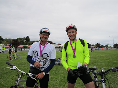
...and then we were done. Through the photo-finish. Be-decked with medals...
Other groups of cyclists gradually gathered at Smales Farm...

...and the queue at the coffee kiosk grew very long...


This was a fun event. I hope the donation to charity was a good one. The bike-party at Smales Farm was fun. Everyone was surprised the BBQ sausages were free, and so were the drinks and treats. The sponsors had as much fun as we did. Looking forward to next time.

Friday, December 30, 2011

Auckland Transit by Alan Hoffman

These slides were shared with me by Alan Hoffman of Mission Group, USA, at a conference on public transport held in Sydney in 2002. I was there to talk about the design of the Northern Busway, as Chair of North Shore City Council's Works and Environment Ctte. Alan's presentation is as relevant to Auckland's situation today as it was then. He begins with the age old questions which have been asked repeatedly in Auckland....

He notes the classic "is it about fare prices or is it about time saving" question. We have the same question in Auckland. We have the same outcome as US - especially when it comes to bus transit that's not on the busway. It's generally regarded as a poor service for people on low incomes.

He makes simple points about market research which echo much of what has been found in Auckland. We are easily able to capture the patronage of the proportion of Aucklanders who "prefer to use public transport". The trick is the next tranche. What needs to happen for them to take public transport?

The big thing is time saving. He makes the huge point that "you have to want to save their trip times". That means the service provider has to be committed to saving travel times by building public transport services that are faster, and more reliable, than travelling by car. And the "how" is by increasing the number of direct, express services. We have some of these in the Northern Busway. We need more in other parts of the bus network.


This slide is a development of the same point. It is about making public transport indispensable. But that's not necessarily for absolutely everybody in Auckland. It is built up by targeting areas and targeting geographies.


This slide emphasises the need for connectivity. That was a key factor in my approach to straightening Auckland bus routes.  

These next two slides reflect Auckland's current land use and public transport planning strategy....

.... and emphasise the goal of making a network that is useful...

I was lucky to go with the Parliamentary Commissioner for Environment's study trip to Curitiba almost 10 years ago. It is an extraordinary exemplar, and one which is cited by Alan in this slide. You can read here what Curitiba's goal was - an unattainable goal a bit like Auckland's sometimes appears to be. So Curitiba responded by doing what it could. Step by step. Auckland needs to do the same. Existing radial bus services need to be reorganised into a high frequency network which connects Auckland's towns, and cross-town orbital or direct connections can follow.

Parnell to Museum = Steep Walk

If you follow this blog you may have noticed some grumpy postings about the location currently proposed by Auckland Council for a railway station at Parnell. These include: Parnell Pet Project Politics, Parnell Station - Shakespearean Tragedy, Parnell Station - Poor Process Continues.

A big part of the justification cited for the location is that it affords easy access to the Museum, despite the fact the location is in the cleft of a steep gully. As this sequence of images illustrates. To the left is a walk many of you may have taken in the heart of Auckland. It's from Kitchener Street (top of Victoria), up a paved walkway and steps, to the flagpole on Albert Park. From A to B. You can check the physical elevations of these points using Google Earth. The elevation of A is 99 feet, while that of B is 131 feet, which indicates you climb 32 feet vertically in that walk. Which I know leaves people I know puffed taking this walk on the way to Maidment Theatre from the car park.

This aerial shows a walk I take quite a bit when I'm walking to University from the ferry. From Custom St East, up Emily Place, through Emily Park to the bottom of Princes Street, and then up to Waterloo Quadrant, and so on. The elevations are as follows: A is 39 feet, B is 69 feet, c is 97 feet, and D is 131 feet. I get a bit puffed doing this walk briskly - and I'm cycling fit. Do the math and you see that the vertical climb, from A to D is 92 feet.
This shows the proposed location for Parnell Station (Point A), and a possible route up to the Museum. As far as I know, no budget has yet been allocated for this path and/or steps. It needs to go through some native bush. The elevation of proposed Parnell Station is 62 feet. The elevation of Point B is 163 feet, of Point C is 191 feet, and a slight incline from there up to the museum at Point D at 200 feet.

The whole climb is 138 feet, and there is very steep climb out of the gully of more than 100 feet. This might be a walk in the park for some - but it does not constitute easy and convenient access to the museum. It certainly does not justify building a railway station at this location.

Wednesday, December 21, 2011

Public Interest and Queens Wharf

Just wanted to show what Auckland Council is allowing, incrementally, on Queens Wharf. Right now. I took this picture from the end of Queens Wharf looking out to the Harbour entrance. You can see Mt Victoria and North Head to the left. A signature view from Auckland's public waterfront.

I took the picture about a year ago.
This image is from a blog I posted a couple of months ago, showing how that view would change, if Ports of Auckland expansion plans went ahead.
This photo-shopped image shows how that view could change after the reclamation. In fact it is likely to be even worse because Ports want to stack containers high on their newly reclaimed land to cope with an almost quadrupling of container volumes. 
But sadly, that view has already changed. I took this photo today. This incredibly ugly and threatening fence has gone up. A sign of things to come on Queens Wharf. Which is already turning into a taxi rank and car park for all and sundry.

I appreciate there are gates in this fence which are usually open when there is not a cruise ship there. But the fence is a hundred metres long. Ugly and threatening.
This fence is presumably needed when a cruise ship visits. A far cry from the striking red fence that kept the public away from the port in days gone by. There are so many other more creative ways to temporarily protect the cruise ship industry from the attention of Auckland's public. Given that the majority of days the whole wharf is available to the public, surely it is in the public interest NOT to have a permanent fence like this.

One leader described Queens Wharf as Auckland's next Regional Park. Do we really need permanent fences like this in public places? 

Straighten Auckland Bus Services

This is a map of Auckland's tram routes when it had tram routes. These routes shaped Auckland's development for many years. The car and motorways have shaped Auckland since. We do have a rudimentary public transport system, primarily based around a cluster of bus services that have been developed over time. Many cities have developed this way. Many cities have rationalised and developed their bus services. Auckland planners are considering what's best for the future of Auckland's bus services. I've spent some time looking at it....


This map (which you can expand by clicking) is built up from the bus maps provided by Auckland Transport. Apart from the Northern Busway - and even including it - you can see that each bus service (which has a unique number) is represented by a line on the map. Thus the more services that run along a corridor, the thicker the corridor, made up of a rainbow of different services. This is one of the reasons why Auckland's bus services are not intuitive, and are difficult to understand for new users and tourists alike.

This map shows the approximate geographic areas of responsibility of the different bus operators which contract to Auckland Transport to provide subsidised bus services. The fact that there are a range of different operators, each with contracts which are a form of property right, presents a challenge to those seeking to rationalise bus services. Interestingly, when I visited Curitiba with a study group we learned that there had been hundreds of bus operators, and that these were rationalised to less than a dozen. Key in that restructure was the idea that bus services should be in the form of a network, and that buses did not stop in the city centre, instead they went through the city centre, allowing passengers to change there etc. This experience was fundamental to my understanding of what = a rational bus system.


This map is my arterial simplification of the Auckland Transport bus map listed above. Other factors that have been taken account of in this rough map - which essentially shows the roads that have the most different bus services running along them - includes that the routes should not directly compete with rail services, and also that they should echo the historic tramline layout. So this map is a bus network map.


This map is a close up of the map above. It shows the main arteries of the bus network. These arteries could contain end-to-end high frequency services by rationalising the bus services that run along those corridors. For example, the Northern Busway service - run by Ritchies - should not terminate in Auckland CBD, it should run through the CBD and along one of the other arteries (eg to the airport, to Howick, or Flatbush). This would require a shared contract between the operators who currently provide services on just one of these arteries. I am sure that incentives could be found to make this a worthwhile development for operators - without throwing the baby out with the bathwater.


And then Auckland could have a high frequency public transport bus system that was a genuine network. An arterial bus network. Without complexity. Not everybody would benefit in this rationalisation, but it would deliver a network system capable of considerable expansion, and which would be far more reliable - provided the inidividual arterties were properly protected from congestion, and freed up for buses.

Wednesday, December 14, 2011

Parnell Station - Poor Process Continues

Yesterday I made my submission to Auckland Council's "Auckland Plan". Part of it was about Parnell Station, and I used this slide to show the 3 options that used to be on the table. (Both Auckland City Council and Auckland Regional Council reports preferred the Parnell Overbridge site as the best location.) In my last blog on this: Parnell Station - Shakespearean Tragedy I described my experiences trying to inform the "notify-or-non-notify" decision regarding the need to alter the designation of Domain land to provide for the new Super City's decision to opt for the Cheshire Street option for Parnell Station.

However my direct approach to appointed commissioners was not appreciated, so instead I sought, under the Official Information Act, the information that was provided by Super City officers to commissioners, so they could make their "notify-or-non-notify" decision. That information has come, and I had the opportunity to look at it today.


The LA4 part of that information reviews the visual and amenity effects of the change to the designation. That review contains these pictures, which give you an idea of what the lay of the land is like in the area of the Cheshire Street option.

As you can see it's fairly deserted in this gully.....

Looking south (picture to the left here) you can just make out the tunnel in the distance.

Looking East (left of picture) you can see that the line is elevated above the surrounding land which is why the track will have to be lowered by up to 1.75 metres. According to the documents 17,000 cubic metres of earthworks will be required, which is one reason why the project will need to take about 2,500 square metres of the Domain in order to build retaining walls and such like, and to accommodate the necessary realignment of the track (away from the Domain) in order to accommodate the proposed railway platforms.
This image looks North from the same point, ie downhill toward Carlaw Park and the Parnell Overbridge....

This image from Google Earth shows the Super City's preferred option at Cheshire Street. You can see again how squeezed into the gully this option is. In the background you just make out the museum - which will be about a kilometre walk away, uphill, probably quite a nice walk through the bush.

The information provided to commissioners is voluminous in terms of the effects on bush, archaeology, heritage, views and such things should the designation change go ahead. But there is almost no information in terms of the effects of what the designation change will permit - which is that a railway station built at that location will almost certainly preclude the construction of any other more useful station being built in the vicinity.

The information states clearly the statutory context. Which is s.181 of the RMA. This allows a requiring authority to make an application to a territorial authority to alter a designation. (ie: this provides for the Super City to apply to itself to change its own designation.)

Critically, s.181(3)(a)(i) states:
(3) A territorial authority may at any time alter a designation in its district plan if - (a) the alteration - (i) involves no more than a minor change to the effects on the environment associated with the use or proposed use of land...concerned; or....

This is the nub. One effect of the proposed use of the land (a railway station at Cheshire Street), will be that other options for the Parnell Station will be precluded. That is clearly a very significant effect on the Auckland environment.

Though that effect is not explicitly identified in any of the documents that were provided to Commissioners by Super City officers.

The information provided to commissioners by Super City, includes The Tonkin and Taylor Report entitled: Minor Alteration to the Designation: Parnell Enabling Works and dated November 2011.

This report does have a short section headed: "Consideration of Alternatives" which refers to the three options illustrated at the start of this posting. This section states of the Parnell Bridge Option:
The bridge would require modification in order to accommodate the station platforms, and significant track lowering towards Parnell Rail tunnel to achieve the appropriate gradient. However, this location would provide direct connection to Downtown Auckland, the Carlaw Park development and the University of Auckland and AUT.
The Parnell Bridge Option location is illustrated in the Google Earth image shown. You can see how well this location would serve Vector Arena and all of the land uses that are currently developing in the vicinity. This area has the development and transit oriented development potential of a Newmarket.

However the "Assessment of Effects on the Environment" section of the Tonkin & Taylor report makes no mention at all of the negative and precluding effects of building the Parnell Station at Cheshire Street - instead of the Parnell Overbridge option preferred by Auckland City Council and Auckland Regional Council officers. Instead the report describes the Parnell Overbridge option as "not feasible". Tell that to the engineers who rebuilt the Newmarket Viaduct.

It is time that this charade was brought to an end. Before it destroys the credibility of the Council and Auckland's railway network.

And as an end-note, here's a picture of the Parnell Overbridge. Quite a classic structure with its stone pillars. Crying out for a sensitive heritage station on top.

There's hundreds of them round the world. A good place to put a station - doesn't take up land. It's in the airspace, and can be central to the city.

Here's a simple example in China. So you can see it's not rocket science. Highly feasible in fact.


And if it's a heritage finish that is needed - to match the existing character of the Parnell Overbridge - here's a heritage railway station in Berlin. There may even be a way of incorporating the old Newmarket station building into an overhead station on the Parnell Overbridge. Now wouldn't that be a world-class win-win.

Sunday, December 11, 2011

Biking - TelstraClearChallenge

I had the pleasure of taking part on Sunday in the TelstraClearChallenge cycling event. The 15 km "bike across the bridge along the busway and end up at Smales farm" event was what I was up for. These pics show riders gathering at Shelley Beach Road for the start....


Here you can see they look a bit worried. The start was delayed by about an hour. A policeman explained that apparently the buses hadn't started building the road safety barrier until 3:00am, when the plan had been to start at 1:00am. So it meant the authorities weren't happy to let cyclists use the route until it was completely safe...


...then it was all go, and race officials divided cyclists off into big groups. Each group was started separately. We'd all been told, "no more than two abreast over the bridge...". If you did the math, assuming cyclists went up the bridge at about 10kph, and biked a metre apart, then it would only take a little over an hour for 4000 to go over....

It appeared that the 100 km riders were being sent off first. I knew the bridge had to be cleared by 9:00am. Wasn't sure what would happen to that arrangement if the start had been delayed by an hour....

We angled for position. It looked like a few 15 km riders were getting mixed up with the 100km riders and the officicals weren't complaining...

...and then quite suddenly, we were part of the next group, and we were off. Exciting. Downhill...

...and then we were out of the trees and there was the bridge. Even though the wind speed was about 10 knots, gusting 18 knots, it somehow seemed to blow over us...
Here's Pieter Watson. Another Devonport cyclist. We did the event together. Great company...
And so began the climb up the bridge. I had expected it to be hard work - with head wind - combined with 5 degrees of incline. But it was surprisingly easy. And such fun...


The buses made quite a difference to the wind effect I think. We seemed to be in the wind shade. Certainly the windows made great mirrors!

...then we were at the top. The views were great. The wind was still quite gentle. The Goldilocks effect: not too hot, and not too cold...
...and the down the other side. Man - now that was a quick section...


Here's Pieter as we biked alongside Shoal Bay. Buses forming a safety barrier ahead. Couldn't help remember how hard I'd tried to get a cycleway built along this alignment when the busway was planned. At the time engineers kept saying: "What about the dotterels... they don't get scraed off by cars... but they do get scared off by bikes...". Man oh man.


...and through Akoranga Station. For some reason I thought we would turn off shortly thereafter. At Smales Farm....
Here's me. Smiling despite the realistion that we had a little more distance to go. All the way to the top of Constellation Drive Station in fact. And that's quite a climb....
I was smiling at the U-Turn at the top, and the downhill was fantastic. Particularly looking at all those riders behind us in low gear...

...and then we were done. Through the photo-finish. Be-decked with medals...
Other groups of cyclists gradually gathered at Smales Farm...

...and the queue at the coffee kiosk grew very long...


This was a fun event. I hope the donation to charity was a good one. The bike-party at Smales Farm was fun. Everyone was surprised the BBQ sausages were free, and so were the drinks and treats. The sponsors had as much fun as we did. Looking forward to next time.