|
|
|
|
|
|
|
|
|
|
|
|
Wednesday, October 26, 2011
Planning for Auckland Planning


Queens Wharf = Queens Park
|
|
|
 On Sunday 12th September 2010 a couple of Chinese warships came to visit Auckland. They tied up at Queens Wharf and I was amazed at the level of interest from the local community. Queues all the way back to the Red Gates. For a couple of days. There were big crowds when a pair of Korean warships came around the same time. These happenings give an inkling of what could happen on Auckland's international waterfront. If only Auckland's planners and councillors could be persuaded to see what is happening around them. And to share the waterfront love. On Sunday 12th September 2010 a couple of Chinese warships came to visit Auckland. They tied up at Queens Wharf and I was amazed at the level of interest from the local community. Queues all the way back to the Red Gates. For a couple of days. There were big crowds when a pair of Korean warships came around the same time. These happenings give an inkling of what could happen on Auckland's international waterfront. If only Auckland's planners and councillors could be persuaded to see what is happening around them. And to share the waterfront love. |
 Even this New Zealand Car Rally event. Very colourful and interesting while it was happening... Even this New Zealand Car Rally event. Very colourful and interesting while it was happening... |
|


Tuesday, October 25, 2011
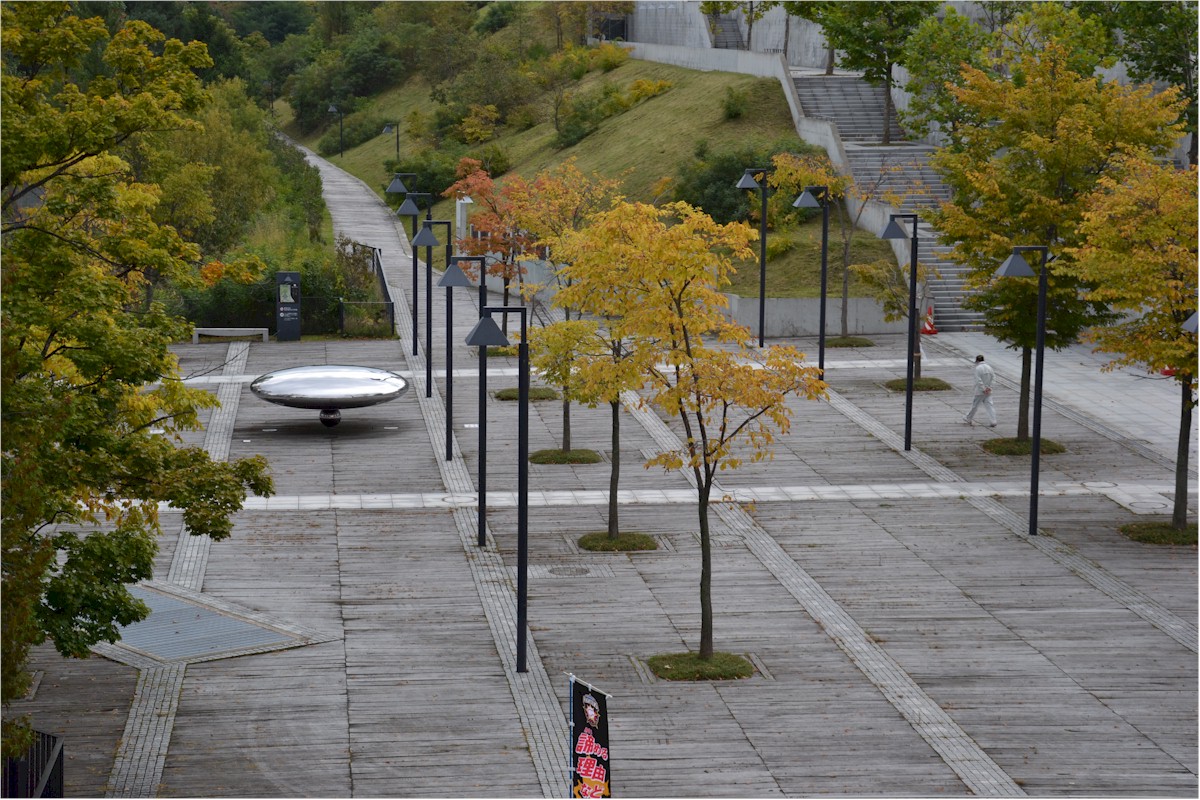
Sapporo Stadium Space Dome
|
|
|
|
|
|
|
|
|
|
|
|


Highway Sound Insulation
|
|
|
|
|


Energy Saving and Insulation
 It's not surprising that other countries are discovering the benefits of conservation and energy efficiency. But I was a bit surprised by this advertisement in Malaysia's The Star newspaper.
The text runs like this:
Cooling costs are no small matter for buildings and homes in tropical countries. The excessive use of air-conditioners for cooling are a huge energy drain, and are a major contributor ro high CO2 emissions and global warming. Recognising this, the Malaysian Government has recently instructed all its officers' air-conditioning systems to be set no lower than 24 degrees centigrade, in a bid to reduce the amount of energy used....The advertisment advocates mineral wool insulation, citing a study suggesting that Malaysia "can potentially save a total of 1,483 GWh annually - corresponding to the capacity of a 242 MW power plant."
Interesting. See: www.mimg.org.my
Sabotaging Parnell Station
 Rumour has it that I am being charged with sabotage of the proposed Parnell Railway Station. Cllr George Wood is facing similar accusations. Apparently because he has written to the Auditor General expressing concerns about the way the Parnell Railway Station project is being gerry-mandered through Auckland Councillors and through Auckland Council processes.
A couple of weeks ago I did write to NZ Herald:
"So. Auckland Council and KiwiRail are full steam ahead with a railway station at Parnell which is in conflict with Auckland Spatial Plan criteria for prioritising infrastructure projects, and before consulting the public.Sabotage? far from it. The truth of the matter is that I DO support a railway station at Parnell, but NOT the option that is being pushed through by certain Auckland Councillors.
Not only that but Auckland Council and Kiwi Rail plan to shut down a crucial section of Auckland's rail network to railroad this project through before Christmas. It is hard to understand why Auckland Council would allow this abuse of process. The chosen site was ranked at the bottom of three Parnell Station options assessed by Auckland Regional Council last year.
This manipulation and speed has all the hallmarks of the political interference that foisted the costly Helensville rail service failure on Auckland three years ago. Don't let it happen, Auckland Council unless due process has been followed."
I have provided the background to this project in previous blogs, and quoted from Auckland Regional Council reports which quite clearly DID NOT support the option that is now being pushed inside Auckland Council (ie the Cheshire Street option). In particular the ARC report stated:
One key consideration is the potential for transit oriented development around the station in the medium to longer term.And this is the critical point. There is no evidence that intensification to justify a station can occur at this location. Those who advocate for the Cheshire option do it for the wrong reasons. They want to support the heritage buildings there - by building the Parnell Railway Station in the wrong place. I support heritage buildings. But they should not by themselves force Auckland Rail development nor the location of stations.
From the analysis completed by the Auckland Regional Transport Authority and ACC to date it is apparent that a station at Carlaw Park would support the business node, university, Vector Arena and provide reasonable access to the Parnell centre, irrespective of any future land use changes in the vicinity of the station.
A station at Cheshire Street will be reliant on significant redevelopment in the area as part of comprehensive masterplan. The KiwiRail site is strategically important, close to Parnell, offers wide views and amenity, overlooking the open space of the Domain, likely to have high land values (assist redevelopment), enable growth of Parnell without affecting the heritage character of the main street, etc.
If a significant redevelopment can be delivered in conjunction with station development, then this location for a future station should be supported.
If the future use of the Cheshire Street site is not transit supportive (i.e. it provides for few residents or employees, is not designed to support walking and PT use and is designed for vehicles) then the location of the station should not be supported.
When you build railway station infrastructure you catalyse the transformation and development of a piece of city. Such as at Newmarket and New Lynn and Britomart. The Cheshire Street option can never be that. And its construction will undermine and sabotage the best option for Parnell and Auckland.
I would like to remind Auckland Councillors of its own Draft Auckland Plan. It states at s.197: "Critical infrastructure underpins Auckland's development...". And at s.198: "Investment must connect with the sequencing of development in the identified priority areas...". One of those priority areas is the City Centre - which doesn't include Parnell. So how does any Parnell Station jump that hurdle? And s.191 underlines that infrastructure investment policies: "...include optimising investment and ensuring that it delivers the greatest return...".
But the big policy commitment about railway stations is set out at s.172: "Intensification is encouraged around these stations as it will maximise infrastructure investments."
So. Councillors. Why push on with a Parnell Railway station option that will undermine this policy (because its location is not conducive to the scale of intensification and supportive land uses offered by other options)? Why push on with an option that will sabotage the possibility of a more appropriately located Parnell Station?
I support a railway station at Parnell. One that is consistent with Auckland Council's own Spatial Plan. That is why I hope to successfully sabotage the option currently lined up for Auckland Council endorsement. Before its hasty implementation sabotages the future development of Auckland Rail and land use in Parnell.
Monday, October 24, 2011
Talking Earthquakes & Fission in Japan
|
|
This is a little extract from my presentation. After explaining nuclear power (and that our very own Sir Ernest Rutherford was the first to split the atom), my job was to explain that water cooling is a critical part of a nuclear power station, and that when tsunami knock that out, you rapidly go into a nuclear melt-down. It was interesting. Believe me... - I could know how to make power from an atom. Also, I could know about New Zealand and Auckland! I want to go there someday! - Tatsuki EtoI think I missed my calling. |


Tuesday, October 18, 2011
Port Plans Will Cut Views
|
Does it matter? Yes it does.... |
|
|
|
|
|
|
If you want to protect Queens Wharf so it can be used as Queens Park (not a cruise ship park), then you need to put in a submission about that too. |


Monday, October 17, 2011
Serious Public Space Provision
|
|
|
|
|
|
|
|
|
|
|
|
|
|
|
|
|
|
|
|
|
|
|
|
|
|
|
|
|
|
|
|
|
|
|
|
|
|
|
|


Wednesday, October 26, 2011
Planning for Auckland Planning
|
|
|
|
|
|
|
|
|
|
|
|
Queens Wharf = Queens Park
|
|
|
| On Sunday 12th September 2010 a couple of Chinese warships came to visit Auckland. They tied up at Queens Wharf and I was amazed at the level of interest from the local community. Queues all the way back to the Red Gates. For a couple of days. There were big crowds when a pair of Korean warships came around the same time. These happenings give an inkling of what could happen on Auckland's international waterfront. If only Auckland's planners and councillors could be persuaded to see what is happening around them. And to share the waterfront love. |
| Even this New Zealand Car Rally event. Very colourful and interesting while it was happening... |
|
Tuesday, October 25, 2011
Sapporo Stadium Space Dome
|
|
|
|
|
|
|
|
|
|
|
|
Highway Sound Insulation
|
|
|
|
|
Energy Saving and Insulation
It's not surprising that other countries are discovering the benefits of conservation and energy efficiency. But I was a bit surprised by this advertisement in Malaysia's The Star newspaper.The text runs like this:
Cooling costs are no small matter for buildings and homes in tropical countries. The excessive use of air-conditioners for cooling are a huge energy drain, and are a major contributor ro high CO2 emissions and global warming. Recognising this, the Malaysian Government has recently instructed all its officers' air-conditioning systems to be set no lower than 24 degrees centigrade, in a bid to reduce the amount of energy used....The advertisment advocates mineral wool insulation, citing a study suggesting that Malaysia "can potentially save a total of 1,483 GWh annually - corresponding to the capacity of a 242 MW power plant."
Interesting. See: www.mimg.org.my
Sabotaging Parnell Station
Rumour has it that I am being charged with sabotage of the proposed Parnell Railway Station. Cllr George Wood is facing similar accusations. Apparently because he has written to the Auditor General expressing concerns about the way the Parnell Railway Station project is being gerry-mandered through Auckland Councillors and through Auckland Council processes.A couple of weeks ago I did write to NZ Herald:
"So. Auckland Council and KiwiRail are full steam ahead with a railway station at Parnell which is in conflict with Auckland Spatial Plan criteria for prioritising infrastructure projects, and before consulting the public.Sabotage? far from it. The truth of the matter is that I DO support a railway station at Parnell, but NOT the option that is being pushed through by certain Auckland Councillors.
Not only that but Auckland Council and Kiwi Rail plan to shut down a crucial section of Auckland's rail network to railroad this project through before Christmas. It is hard to understand why Auckland Council would allow this abuse of process. The chosen site was ranked at the bottom of three Parnell Station options assessed by Auckland Regional Council last year.
This manipulation and speed has all the hallmarks of the political interference that foisted the costly Helensville rail service failure on Auckland three years ago. Don't let it happen, Auckland Council unless due process has been followed."
I have provided the background to this project in previous blogs, and quoted from Auckland Regional Council reports which quite clearly DID NOT support the option that is now being pushed inside Auckland Council (ie the Cheshire Street option). In particular the ARC report stated:
One key consideration is the potential for transit oriented development around the station in the medium to longer term.And this is the critical point. There is no evidence that intensification to justify a station can occur at this location. Those who advocate for the Cheshire option do it for the wrong reasons. They want to support the heritage buildings there - by building the Parnell Railway Station in the wrong place. I support heritage buildings. But they should not by themselves force Auckland Rail development nor the location of stations.
From the analysis completed by the Auckland Regional Transport Authority and ACC to date it is apparent that a station at Carlaw Park would support the business node, university, Vector Arena and provide reasonable access to the Parnell centre, irrespective of any future land use changes in the vicinity of the station.
A station at Cheshire Street will be reliant on significant redevelopment in the area as part of comprehensive masterplan. The KiwiRail site is strategically important, close to Parnell, offers wide views and amenity, overlooking the open space of the Domain, likely to have high land values (assist redevelopment), enable growth of Parnell without affecting the heritage character of the main street, etc.
If a significant redevelopment can be delivered in conjunction with station development, then this location for a future station should be supported.
If the future use of the Cheshire Street site is not transit supportive (i.e. it provides for few residents or employees, is not designed to support walking and PT use and is designed for vehicles) then the location of the station should not be supported.
When you build railway station infrastructure you catalyse the transformation and development of a piece of city. Such as at Newmarket and New Lynn and Britomart. The Cheshire Street option can never be that. And its construction will undermine and sabotage the best option for Parnell and Auckland.
I would like to remind Auckland Councillors of its own Draft Auckland Plan. It states at s.197: "Critical infrastructure underpins Auckland's development...". And at s.198: "Investment must connect with the sequencing of development in the identified priority areas...". One of those priority areas is the City Centre - which doesn't include Parnell. So how does any Parnell Station jump that hurdle? And s.191 underlines that infrastructure investment policies: "...include optimising investment and ensuring that it delivers the greatest return...".
But the big policy commitment about railway stations is set out at s.172: "Intensification is encouraged around these stations as it will maximise infrastructure investments."
So. Councillors. Why push on with a Parnell Railway station option that will undermine this policy (because its location is not conducive to the scale of intensification and supportive land uses offered by other options)? Why push on with an option that will sabotage the possibility of a more appropriately located Parnell Station?
I support a railway station at Parnell. One that is consistent with Auckland Council's own Spatial Plan. That is why I hope to successfully sabotage the option currently lined up for Auckland Council endorsement. Before its hasty implementation sabotages the future development of Auckland Rail and land use in Parnell.
Monday, October 24, 2011
Talking Earthquakes & Fission in Japan
|
|
This is a little extract from my presentation. After explaining nuclear power (and that our very own Sir Ernest Rutherford was the first to split the atom), my job was to explain that water cooling is a critical part of a nuclear power station, and that when tsunami knock that out, you rapidly go into a nuclear melt-down. It was interesting. Believe me... - I could know how to make power from an atom. Also, I could know about New Zealand and Auckland! I want to go there someday! - Tatsuki EtoI think I missed my calling. |
Tuesday, October 18, 2011
Port Plans Will Cut Views
|
Does it matter? Yes it does.... |
|
|
|
|
|
|
If you want to protect Queens Wharf so it can be used as Queens Park (not a cruise ship park), then you need to put in a submission about that too. |
Monday, October 17, 2011
Serious Public Space Provision
|
|
|
|
|
|
|
|
|
|
|
|
|
|
|
|
|
|
|
|
|
|
|
|
|
|
|
|
|
|
|
|
|
|
|
|
|
|
|
|


