The planned balance of private and public urban outcomes at Auckland’s redeveloped Wynyard Quarter has won international recognition. Private investors have developed successful structures and businesses there, while visitors, residents and tenants alike enjoy a wide range of publicly developed and owned spaces, squares and amenities including playground areas for children and youth. These inclusive common areas are attractive and already well used by citizens from all parts of Auckland.
The same cannot be said of Auckland’s Downtown waterfront where the existing commons is under threat of being sold for retail infill, encroached for private and exclusive uses, and congested by traffic particularly bus public transport.
This is not a new phenomenon for Auckland’s waterfront central business district. Quay Park, Britomart, Downtown and Viaduct precincts are relatively recent developments mostly built upon land reclaimed from the seabed by Auckland Harbour Board which it later redeveloped and vacated when containerization rendered wharves largely obsolete.
Over the past fifty years waterfront redevelopment plans have gradually rezoned CBD land that was previously used for port purposes into typically urban purposes by permitting office and retail development. Changes have always been contested by neighbouring property owners protecting private interests, and by Auckland City Council whose duties included provision of public infrastructure goods including transport and water infrastructure, and public commons including streets and public squares.
Civic calculations of gains and losses have played a critical role in decisions about the balance that is needed between enabling private investment and economic growth, and providing sufficient public commons to meet the civic social and cultural needs of the city’s growing and diversifying population.
One story about this planning activity is the Auckland Harbour Board’s sequence of headquarter buildings. Before 1970 Auckland Harbour staff were housed in an elegant three storey building at the corner of Quay and Little Queen Streets. Little Queen Street no longer exists having been “stopped” and swapped for Queen Elizabeth Square when Auckland Harbour Board redeveloped its Downtown site in the 1970’s to make room for the Air New Zealand Tower which it then occupied (now named the HSBC building). In the 1980’s, claiming that its lease was running out, Auckland Harbour Board applied to build a new headquarter building on Quay Street at the base of Princes Wharf. At the time Auckland City Council played a critical role in ensuring that open public space would be provided “contemporaneously” beneath the new futuristic looking building, and along parts of Quay Street.
In the mid 1990’s Ports of Auckland Ltd (established from Auckland Harbour Board) sublet all office space in that new headquarter building, and, arguing that the associated waterfront spaces were unsuccessful and better used for retail and office purposes, obtained consents to completely infill to the wharf deck. Quay Street public space was lost, the Port company gained increased rents, and opportunities to redevelop that commons and make the public spaces along Quay Street and Princes Wharf more successful were also lost.
Corruption might be too strong a word to describe what happened behind the scenes in this little bit of Auckland’s waterfront redevelopment history, but the urban politics relating to how public investment was allocated to produce something that looked like a common good but which eventually promoted gains in asset values for privileged property owners is an unhappy precedent.
Proposals to sell the Queen Elizabeth Square commons and reinvest the proceeds in possible waterfront spaces along Quay Street are being challenged by a number of public interest associations (including Auckland Architecture Association, Urban Auckland, Auckland Civic Trust, Living Streets Aotearoa). While Auckland Council has for at least two years issued media releases and engaged in selective stakeholder engagement processes relating to these proposals and plans for the Central Rail Link which passes beneath the square, it was not until June this year that statutory submissions were sought. Submissions generally acknowledge that Queen Elizabeth Square is an unsuccessful, windy and shaded space, raise questions about the planning processes for the whole downtown area which includes a new tower and the relocation of the downtown bus terminal, and call for the provision of commensurate or better public space.
Auckland’s waterfront is changing from being an industrial port to becoming a place that is attractive and interesting to the public and also to private investors. This is the story of urbanization around the world. The better the commons the more likely it is to be raided and appropriated by those seeking to make gains and to profit from it. Queen Elizabeth Square is 1800 square metres of prime commons estate within a city block which is being entirely redeveloped apart from two pre-existing towers. This urban commons was established by Auckland City Council when it built Little Queen Street. It is an urban space qualified and defined by surrounding buildings. Comprehensive redevelopment of the downtown site provides the opportunity to create a downtown square that is sunny, sheltered from the wind, and qualified by the buildings and uses that can surround it. Residents, office workers and visitors alike can use it.
Precinct Properties owns much of the Downtown site and has a conditional arrangement with Auckland Council to purchase Queen Elizabeth Square for $27 million. Its property promotions for the currently proposed redevelopment show the main 'public' space to be created is a six metre wide glassed-in laneway lined with shops aimed at “premium and high-end apparel retailers” and “stores which will attract the cruise ship and tourist markets”. This would be another waterfront retail infill development.
Streets are an important part of a city’s urban commons. Provided they are not congested with traffic. Streets and squares are the places where social and cultural exchange occurs within a city and where civic values of tolerance and understanding are fostered amongst a city’s people and its communities. Auckland needs more urban commons so that the possibility of an egalitarian population can be realised. These precious CBD spaces must not be handed over to become playgrounds dedicated for the use of “high net-worth individuals”. The redevelopment of the downtown block provides the excuse to properly incorporate the equivalent of Queen Elizabeth Square as a successful urban commons within the new built fabric of downtown Auckland.
Thursday, October 15, 2015
Hanoi: Density through land use planning

Here's a useful paper about Vietnamese housing and buildings combining shop and home. I've quoted from it in this post.
If you're interested in recent Vietnam property tax and land ownership reforms - here's a good paper.


Article 10.- Classification of urban areas, streets, land positions in urban centers of each specific land category for land price determination For urban residential land, non-agricultural production and/or business land and other non-agricultural land categories in urban centers such as land for construction of working offices, construction of non-business works; land used for defense or security purposes; land used for public purposes, including traffic land, irrigation land; land for construction of cultural, medical, education and training, physical training and sport facilities in service of public interests; land with historical and/or cultural relics, scenic places; land for construction of other public works as provided for by the Government; land used by religious establishments; land with works being communal houses, temples, shrines, small pagodas, worshipping halls, ancestral worship houses; land for cemeteries, graveyards and other non-agricultural land as provided for by the Government shall be graded according to types of urban centers, types of street and land positions for price determination. 1. Urban centers include cities, provincial capitals, district townships, set up and graded under decisions of competent state agencies. Urban centers are classified into 6 grades: special-grade urban centers, grade-I urban centers, grade-II urban centers, grade-III urban centers, grade-IV urban centers, grade-V urban centers according to the current regulations of the State. For provincial capitals, district townships not yet graded as urban centers, they shall be classified into grade-V urban centers. 2. Classification of urban streets Types of street in each grade of urban center shall be determined mainly on the basis of profit-generating capability, infrastructure conditions convenient for daily- life, production, business, service, tourist activities, on the distance to urban centers, trade, service and tourist centers. Streets in each type of urban center are classified into different grades of street with ordinal numbers from No. 1 on. Grade-I streets apply to land in the hearts of urban centers, trade, service and/or tourist centers; have the highest profit-generating capacity and the most convenient infrastructure conditions; the following street grades from grade 2 onwards shall apply to land not lying in the hearts of urban centers, trade, service and/or tourist centers, with lower profit-generating capability and less convenient infrastructure conditions. In cases where a street consists of various street sections with different profit-generating capabilities, different infrastructure conditions, such street sections shall be graded into the corresponding street grades. 3. Land positions in every street grade of each grade of urban center shall be determined on the basis of profit-generating capability, infrastructure conditions favorable for daily-life, production, business and/or service activities, on the distance to traffic axes. Land positions in each street grade of each urban center grade shall be classified into positions from No. 1 on. Position No. 1 shall apply to land adjacent to streets (with frontage) with the highest profit-generating capability, most convenient infrastructure conditions; the following positions from No. 2 onwards shall apply to land not adjacent to streets, with lower profit-generating capability and less convenient infrastructure conditions.


Hue: Governance Heritage

In June 1802 Nguyễn Ánh took control of Vietnam and proclaimed himself Emperor Gia Long. His rule was recognized by China in 1804. Building began in 1804. Which is very recent when you consider the history of Vietnam.
The grounds of the Imperial City are protected by fortified ramparts 2.5 kilometers by 2.5 kilometers, and ringed by a moat. The water in the moat is routed from the Huong River (Perfume River) through a series of sluice gates. This enclosure is the Citadel (Kinh thành). Inside the Citadel is the Imperial City (Hoàng thành), with a perimeter wall some 2.5 kilometers in length. Within the Imperial City is the Purple Forbidden City (Tử cấm thành), a term similar to the Forbidden City in Beijing. Access to the innermost enclosure was restricted to the Nguyễn imperial family.


Hoi An: History of sand loss repeats

I bought a couple of interesting books while I was in Hanoi. One was a collection of academic papers collected at a UNESCO run symposium about Hue which is another world heritage urban site in Vietnam. One of the papers was about the city's geomorphology. It explored what had happened to the sea level over the past 4000 years. Turns out that Vietnam's leaders shared the same concerns as China's leaders did about the effect of traders on the attitude of local population. Which is why those leaders preferred and supported trading centres away from cities like Hanoi and Saigon. Hundreds of years ago when Hue was one of the most successful trading ports in South-East Asia it contained a Japanese city and a Chinese city. There were some Vietnamese locals, but the key Vietnamese role was to tax ships and their loads when they visited the Port.


Trade shifted elsewhere. But the city and its buildings remained pretty much untouched.


Saigon: Remnants of the American War

You're told to start at the top floor. An exhibition there is entitled: "Home Truths". One on the second floor is entitled: "Agent Orange". Little has been spared.


aaaa


A sobering exhibition. Makes you think and reflect. All the more compelling when you've been on the street, drinking and eating with the people. So much laughing and smiling.
Subscribe to:
Posts (Atom)
Thursday, October 15, 2015
CBD Infill Threatens CBD 'Commons'
The planned balance of private and public urban outcomes at Auckland’s redeveloped Wynyard Quarter has won international recognition. Private investors have developed successful structures and businesses there, while visitors, residents and tenants alike enjoy a wide range of publicly developed and owned spaces, squares and amenities including playground areas for children and youth. These inclusive common areas are attractive and already well used by citizens from all parts of Auckland.
The same cannot be said of Auckland’s Downtown waterfront where the existing commons is under threat of being sold for retail infill, encroached for private and exclusive uses, and congested by traffic particularly bus public transport.
This is not a new phenomenon for Auckland’s waterfront central business district. Quay Park, Britomart, Downtown and Viaduct precincts are relatively recent developments mostly built upon land reclaimed from the seabed by Auckland Harbour Board which it later redeveloped and vacated when containerization rendered wharves largely obsolete.
Over the past fifty years waterfront redevelopment plans have gradually rezoned CBD land that was previously used for port purposes into typically urban purposes by permitting office and retail development. Changes have always been contested by neighbouring property owners protecting private interests, and by Auckland City Council whose duties included provision of public infrastructure goods including transport and water infrastructure, and public commons including streets and public squares.
Civic calculations of gains and losses have played a critical role in decisions about the balance that is needed between enabling private investment and economic growth, and providing sufficient public commons to meet the civic social and cultural needs of the city’s growing and diversifying population.
One story about this planning activity is the Auckland Harbour Board’s sequence of headquarter buildings. Before 1970 Auckland Harbour staff were housed in an elegant three storey building at the corner of Quay and Little Queen Streets. Little Queen Street no longer exists having been “stopped” and swapped for Queen Elizabeth Square when Auckland Harbour Board redeveloped its Downtown site in the 1970’s to make room for the Air New Zealand Tower which it then occupied (now named the HSBC building). In the 1980’s, claiming that its lease was running out, Auckland Harbour Board applied to build a new headquarter building on Quay Street at the base of Princes Wharf. At the time Auckland City Council played a critical role in ensuring that open public space would be provided “contemporaneously” beneath the new futuristic looking building, and along parts of Quay Street.
In the mid 1990’s Ports of Auckland Ltd (established from Auckland Harbour Board) sublet all office space in that new headquarter building, and, arguing that the associated waterfront spaces were unsuccessful and better used for retail and office purposes, obtained consents to completely infill to the wharf deck. Quay Street public space was lost, the Port company gained increased rents, and opportunities to redevelop that commons and make the public spaces along Quay Street and Princes Wharf more successful were also lost.
Corruption might be too strong a word to describe what happened behind the scenes in this little bit of Auckland’s waterfront redevelopment history, but the urban politics relating to how public investment was allocated to produce something that looked like a common good but which eventually promoted gains in asset values for privileged property owners is an unhappy precedent.
Proposals to sell the Queen Elizabeth Square commons and reinvest the proceeds in possible waterfront spaces along Quay Street are being challenged by a number of public interest associations (including Auckland Architecture Association, Urban Auckland, Auckland Civic Trust, Living Streets Aotearoa). While Auckland Council has for at least two years issued media releases and engaged in selective stakeholder engagement processes relating to these proposals and plans for the Central Rail Link which passes beneath the square, it was not until June this year that statutory submissions were sought. Submissions generally acknowledge that Queen Elizabeth Square is an unsuccessful, windy and shaded space, raise questions about the planning processes for the whole downtown area which includes a new tower and the relocation of the downtown bus terminal, and call for the provision of commensurate or better public space.
Auckland’s waterfront is changing from being an industrial port to becoming a place that is attractive and interesting to the public and also to private investors. This is the story of urbanization around the world. The better the commons the more likely it is to be raided and appropriated by those seeking to make gains and to profit from it. Queen Elizabeth Square is 1800 square metres of prime commons estate within a city block which is being entirely redeveloped apart from two pre-existing towers. This urban commons was established by Auckland City Council when it built Little Queen Street. It is an urban space qualified and defined by surrounding buildings. Comprehensive redevelopment of the downtown site provides the opportunity to create a downtown square that is sunny, sheltered from the wind, and qualified by the buildings and uses that can surround it. Residents, office workers and visitors alike can use it.
Precinct Properties owns much of the Downtown site and has a conditional arrangement with Auckland Council to purchase Queen Elizabeth Square for $27 million. Its property promotions for the currently proposed redevelopment show the main 'public' space to be created is a six metre wide glassed-in laneway lined with shops aimed at “premium and high-end apparel retailers” and “stores which will attract the cruise ship and tourist markets”. This would be another waterfront retail infill development.
Streets are an important part of a city’s urban commons. Provided they are not congested with traffic. Streets and squares are the places where social and cultural exchange occurs within a city and where civic values of tolerance and understanding are fostered amongst a city’s people and its communities. Auckland needs more urban commons so that the possibility of an egalitarian population can be realised. These precious CBD spaces must not be handed over to become playgrounds dedicated for the use of “high net-worth individuals”. The redevelopment of the downtown block provides the excuse to properly incorporate the equivalent of Queen Elizabeth Square as a successful urban commons within the new built fabric of downtown Auckland.
Hanoi: Density through land use planning
Here's a useful paper about Vietnamese housing and buildings combining shop and home. I've quoted from it in this post.
If you're interested in recent Vietnam property tax and land ownership reforms - here's a good paper.
Article 10.- Classification of urban areas, streets, land positions in urban centers of each specific land category for land price determination For urban residential land, non-agricultural production and/or business land and other non-agricultural land categories in urban centers such as land for construction of working offices, construction of non-business works; land used for defense or security purposes; land used for public purposes, including traffic land, irrigation land; land for construction of cultural, medical, education and training, physical training and sport facilities in service of public interests; land with historical and/or cultural relics, scenic places; land for construction of other public works as provided for by the Government; land used by religious establishments; land with works being communal houses, temples, shrines, small pagodas, worshipping halls, ancestral worship houses; land for cemeteries, graveyards and other non-agricultural land as provided for by the Government shall be graded according to types of urban centers, types of street and land positions for price determination. 1. Urban centers include cities, provincial capitals, district townships, set up and graded under decisions of competent state agencies. Urban centers are classified into 6 grades: special-grade urban centers, grade-I urban centers, grade-II urban centers, grade-III urban centers, grade-IV urban centers, grade-V urban centers according to the current regulations of the State. For provincial capitals, district townships not yet graded as urban centers, they shall be classified into grade-V urban centers. 2. Classification of urban streets Types of street in each grade of urban center shall be determined mainly on the basis of profit-generating capability, infrastructure conditions convenient for daily- life, production, business, service, tourist activities, on the distance to urban centers, trade, service and tourist centers. Streets in each type of urban center are classified into different grades of street with ordinal numbers from No. 1 on. Grade-I streets apply to land in the hearts of urban centers, trade, service and/or tourist centers; have the highest profit-generating capacity and the most convenient infrastructure conditions; the following street grades from grade 2 onwards shall apply to land not lying in the hearts of urban centers, trade, service and/or tourist centers, with lower profit-generating capability and less convenient infrastructure conditions. In cases where a street consists of various street sections with different profit-generating capabilities, different infrastructure conditions, such street sections shall be graded into the corresponding street grades. 3. Land positions in every street grade of each grade of urban center shall be determined on the basis of profit-generating capability, infrastructure conditions favorable for daily-life, production, business and/or service activities, on the distance to traffic axes. Land positions in each street grade of each urban center grade shall be classified into positions from No. 1 on. Position No. 1 shall apply to land adjacent to streets (with frontage) with the highest profit-generating capability, most convenient infrastructure conditions; the following positions from No. 2 onwards shall apply to land not adjacent to streets, with lower profit-generating capability and less convenient infrastructure conditions.
Hue: Governance Heritage
In June 1802 Nguyễn Ánh took control of Vietnam and proclaimed himself Emperor Gia Long. His rule was recognized by China in 1804. Building began in 1804. Which is very recent when you consider the history of Vietnam.
The grounds of the Imperial City are protected by fortified ramparts 2.5 kilometers by 2.5 kilometers, and ringed by a moat. The water in the moat is routed from the Huong River (Perfume River) through a series of sluice gates. This enclosure is the Citadel (Kinh thành). Inside the Citadel is the Imperial City (Hoàng thành), with a perimeter wall some 2.5 kilometers in length. Within the Imperial City is the Purple Forbidden City (Tử cấm thành), a term similar to the Forbidden City in Beijing. Access to the innermost enclosure was restricted to the Nguyễn imperial family.
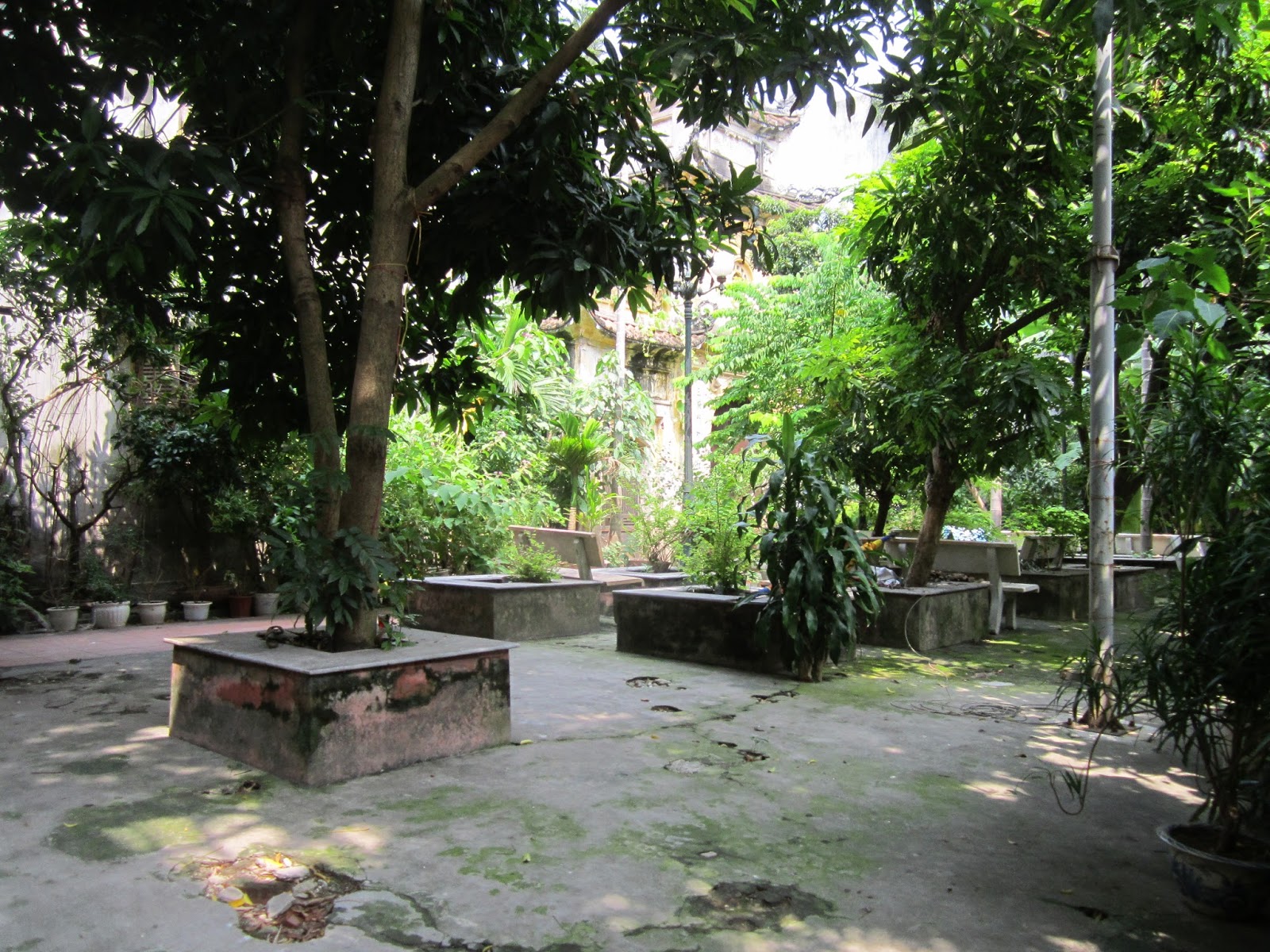
Hoi An: History of sand loss repeats
I bought a couple of interesting books while I was in Hanoi. One was a collection of academic papers collected at a UNESCO run symposium about Hue which is another world heritage urban site in Vietnam. One of the papers was about the city's geomorphology. It explored what had happened to the sea level over the past 4000 years. Turns out that Vietnam's leaders shared the same concerns as China's leaders did about the effect of traders on the attitude of local population. Which is why those leaders preferred and supported trading centres away from cities like Hanoi and Saigon. Hundreds of years ago when Hue was one of the most successful trading ports in South-East Asia it contained a Japanese city and a Chinese city. There were some Vietnamese locals, but the key Vietnamese role was to tax ships and their loads when they visited the Port.
Trade shifted elsewhere. But the city and its buildings remained pretty much untouched.
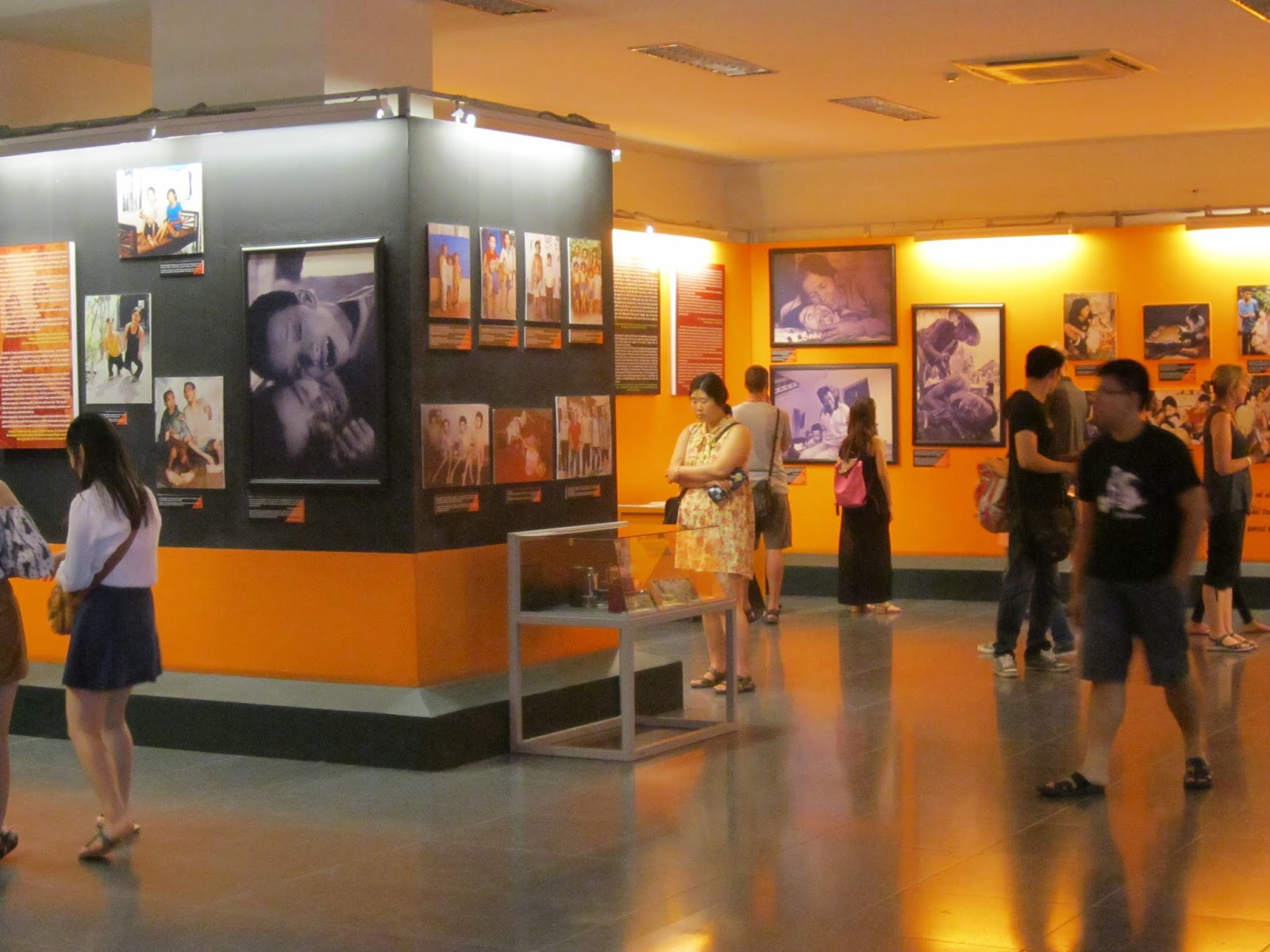
Saigon: Remnants of the American War
You're told to start at the top floor. An exhibition there is entitled: "Home Truths". One on the second floor is entitled: "Agent Orange". Little has been spared.
aaaa
A sobering exhibition. Makes you think and reflect. All the more compelling when you've been on the street, drinking and eating with the people. So much laughing and smiling.
Subscribe to:
Posts (Atom)


