Showing posts with label Auckland Waterfront Park. Show all posts

Wednesday, December 21, 2011

Public Interest and Queens Wharf

Just wanted to show what Auckland Council is allowing, incrementally, on Queens Wharf. Right now. I took this picture from the end of Queens Wharf looking out to the Harbour entrance. You can see Mt Victoria and North Head to the left. A signature view from Auckland's public waterfront.

I took the picture about a year ago.
This image is from a blog I posted a couple of months ago, showing how that view would change, if Ports of Auckland expansion plans went ahead.
This photo-shopped image shows how that view could change after the reclamation. In fact it is likely to be even worse because Ports want to stack containers high on their newly reclaimed land to cope with an almost quadrupling of container volumes. 
But sadly, that view has already changed. I took this photo today. This incredibly ugly and threatening fence has gone up. A sign of things to come on Queens Wharf. Which is already turning into a taxi rank and car park for all and sundry.

I appreciate there are gates in this fence which are usually open when there is not a cruise ship there. But the fence is a hundred metres long. Ugly and threatening.
This fence is presumably needed when a cruise ship visits. A far cry from the striking red fence that kept the public away from the port in days gone by. There are so many other more creative ways to temporarily protect the cruise ship industry from the attention of Auckland's public. Given that the majority of days the whole wharf is available to the public, surely it is in the public interest NOT to have a permanent fence like this.

One leader described Queens Wharf as Auckland's next Regional Park. Do we really need permanent fences like this in public places? 

Thursday, November 3, 2011

Submissions C: Waterfront Plan

Waterfront Public Space and Urban Parkland

The DWP emphasises the need for a “connected and accessible waterfront” (Pg 21). This goal is worthwhile but it sidesteps the more fundamental need for a waterfront urban park – though the images and idea of a Foreshore Avenue (Pg 31, central pictures) – suggest some recognition of that need. The experiences of crowd management during the RWC have brought further focus on the actual capacity of Auckland’s waterfront spaces to accommodate the population.

At a reasonable density of 3 people/square metres, then Quay Street (closed to traffic), Te Whero Island, Wynyard Quarter (as it is now), Princes Wharf, Queen Elizabeth Square, Captain Cook Wharf and Queens Wharf could hold about 300,000 people (these waterfront public spaces amount to an area of about 10 hectares, and all are accessible within 1.5kms of Britomart. This excludes the Wynyard Headland Park which is 2km from Britomart). But people would all be standing at 3 people/sq metre. A crowded waterfront.

Metrics for good provision of central city urban park space/head (as opposed to open space or regional park space provision) of population are available. Used as a promenade and place of enjoyment, such as is evident at Wynyard Quarter, an occupation rate of around 1 person/3 square metres is more appropriate (ie not a crowded environment), giving a casual visitor waterfront capacity of around 30,000 (this assumes that ALL of the spaces listed in the paragraph above are available as waterfront urban park space). However this provision is modest by international standards, and all of Queens Wharf makes up a quarter of that. That is why Queens Wharf is so important as a central city public space.

Submission 3: Waterfront public space planning needs to include provision for urban park requirements, not just connectivity and accessibility.

Monday, October 17, 2011

Serious Public Space Provision

Here's my daughter and a view from the Sapporo Tower, Sapporo, Hokkaido, Japan. You can see Odori Park stretching into the distance. It is located in the heart of the city. Odori Park is about 100 metres wide and 1600 metres long. It is a fantastic public space. An example for Auckland to consider. Sapporo is a new city by Japanese standards. Building started around 1850. Population now is approaching 2 million.

This google image shows the streetscape where Odori Park is located. The street layout is notable - classic grid pattern.

Yellow oblong indicates the outline of Odori Park. The area of this space is about 160,000 square metres. By way of comparison Queens Wharf is 25,000 square metres in area, and the section of Quay Street closed off for Rugby World Cup celebrations was 16,600 square metres. Odori Park is full at certain times of the year in Sapporo for regular events.

This sequence of photos was taken as I walked from one end of Odori Park to the other on a recent Sunday morning. Early, so not many people about yet. It was autumn, but the flowers were out...

People were out walking their dogs and admiring the gardens and generally promenading.

This urban park is intersected by streets which cross it an intervals. Families were out for a walk and breakfast.

There's nothing quite like a fountain. Auckland's waterfront needs a water feature. WindTree is a start. In the background of this photo you can see the Eiffel Tower imitation where I took the distant shot of Odori Park

Behind this pic of the fountain you can see an example of the sculpture that decorates and embellishes this city park.

Great background for those family shots as the kids grow up...

Places for memorials too, and places for activities of all sorts and shapes and sizes...

...activities like this unusual video project where random people stood against a fluttering background and addressed the camera... very Japanese...

Parts of the park are leafy and shaded.

This part contains a stage and theatre with seating for casual audiences. All sorts of seasonal events and festivals are scheduled in this wonderful people place. And I mustn't forget to mention the very good public toilets.

Paved open spaces for more exhuberant running around too - and apparently the making of snow statues in winter...

....and more of the same... no retail outlets demanding money, no cars parked in sight (but great public transport connections just outside the park)... it's an urban park...

There were many quiet corners with bronzes and other artwork for the explorer, and the curious...

And great places just to chill, read the paper, and plug in the IPOD...

Walking a bit further we come to the children's playgrounds to die for (not to be built on at a later date...). This was a very popular slide. An artwork in its own right.

It was colocated with another sort of slide. Almost ceramic material. Long lasting. Very slippery. A challenge for kids and parents. Popular...

As you can see...

Traditional playground equipment had its place also...

Lots of people come by bike to enjoy this park. How about this family machine - a 3 seater - each with a helmet...

I quite liked the old ladies. All gardners. Admiring the plants. And there were some unusual gardens and plants. All nicely signposted...

Remember - all these photos are in the same Odori Park. Sapporo. This is special bit of wood and forest. Quiet and still in the city...

And every now and then you get reminded of the long Japanese history and culture...

OK. Now for something a little different. This map shows Odori Park. But it also shows another feature of Sapporo. That's the river that runs through the middle. Sapporo is not a "waterfront city", but it's got a wonderful river waterfront. You can see a bit of it on the right of this Google Earth shot. These last few pics take you there...

OK. So here's my daughter on her bike. Leading us to the river park...

Along the pavement, across the crossing. This is the Munich Bridge by the way - sister city....

Through the bike gate over the flood stop banks and down into the river bed...

Great cycle paths down there by the way. Super smooth...

It's an amazing park. Slap bang in the middle of the city. Steps on either side which can be used any day it's not flooding...

Interesting concrete finishes on the river banks in some sections. But mostly great swathes of seating. This bunch - in the distance - having a BBQ Japanese style...

See what I mean....

You can really get lost down by the river. But so much informal surveillance from the river bank. One of the safest cities in the world...

Great places to sit and watch the river....

The group I was destined to meet with my daughter set up their BBQs in the middle distance...

Very sociable. In the middle of the city...

And a good time was had by all. Father bonding with daughter over Japan style BBQ...

And then home again on the bike. I was keen on these bronze fishes. So were the Japanese. They were even fishing in this river. I've put this blog up because it shows what a city the size of Auckland can do if it commits to central city public space commensurate with its population. We have the opportunity in Auckland of providing this kind of "World Class" public space on our CBD Waterfront. Or we can fill it up with buildings and cruise ships. I know what I'd like to see.

So. Here's our waterfront. The Quay Street Park - Auckland's equivalent of Sapporo's Odori Park - is shown here in the yellow rectangle. To just past Captain Cook wharf it's about 1500 metres long. But only about 30 metres wide (the width of Quay Street). A total area of 4.5 hectares. We need to make the most of this space. And not enclose parts of it into a canyon of buildings. Give Auckland a sense of space. And it needs to be connected to a Queens Wharf Park (area 2.5 hectares) that is an addition to Quay Park. Quay Park and Queens Park and Wynyard Park. That would show class, and commitment to a quality public park on Auckland's waterfront.

Showing posts with label Auckland Waterfront Park. Show all posts

Wednesday, December 21, 2011

Public Interest and Queens Wharf

Just wanted to show what Auckland Council is allowing, incrementally, on Queens Wharf. Right now. I took this picture from the end of Queens Wharf looking out to the Harbour entrance. You can see Mt Victoria and North Head to the left. A signature view from Auckland's public waterfront.

I took the picture about a year ago.
This image is from a blog I posted a couple of months ago, showing how that view would change, if Ports of Auckland expansion plans went ahead.
This photo-shopped image shows how that view could change after the reclamation. In fact it is likely to be even worse because Ports want to stack containers high on their newly reclaimed land to cope with an almost quadrupling of container volumes. 
But sadly, that view has already changed. I took this photo today. This incredibly ugly and threatening fence has gone up. A sign of things to come on Queens Wharf. Which is already turning into a taxi rank and car park for all and sundry.

I appreciate there are gates in this fence which are usually open when there is not a cruise ship there. But the fence is a hundred metres long. Ugly and threatening.
This fence is presumably needed when a cruise ship visits. A far cry from the striking red fence that kept the public away from the port in days gone by. There are so many other more creative ways to temporarily protect the cruise ship industry from the attention of Auckland's public. Given that the majority of days the whole wharf is available to the public, surely it is in the public interest NOT to have a permanent fence like this.

One leader described Queens Wharf as Auckland's next Regional Park. Do we really need permanent fences like this in public places? 

Thursday, November 3, 2011

Submissions C: Waterfront Plan

Waterfront Public Space and Urban Parkland

The DWP emphasises the need for a “connected and accessible waterfront” (Pg 21). This goal is worthwhile but it sidesteps the more fundamental need for a waterfront urban park – though the images and idea of a Foreshore Avenue (Pg 31, central pictures) – suggest some recognition of that need. The experiences of crowd management during the RWC have brought further focus on the actual capacity of Auckland’s waterfront spaces to accommodate the population.

At a reasonable density of 3 people/square metres, then Quay Street (closed to traffic), Te Whero Island, Wynyard Quarter (as it is now), Princes Wharf, Queen Elizabeth Square, Captain Cook Wharf and Queens Wharf could hold about 300,000 people (these waterfront public spaces amount to an area of about 10 hectares, and all are accessible within 1.5kms of Britomart. This excludes the Wynyard Headland Park which is 2km from Britomart). But people would all be standing at 3 people/sq metre. A crowded waterfront.

Metrics for good provision of central city urban park space/head (as opposed to open space or regional park space provision) of population are available. Used as a promenade and place of enjoyment, such as is evident at Wynyard Quarter, an occupation rate of around 1 person/3 square metres is more appropriate (ie not a crowded environment), giving a casual visitor waterfront capacity of around 30,000 (this assumes that ALL of the spaces listed in the paragraph above are available as waterfront urban park space). However this provision is modest by international standards, and all of Queens Wharf makes up a quarter of that. That is why Queens Wharf is so important as a central city public space.

Submission 3: Waterfront public space planning needs to include provision for urban park requirements, not just connectivity and accessibility.

Monday, October 17, 2011

Serious Public Space Provision

Here's my daughter and a view from the Sapporo Tower, Sapporo, Hokkaido, Japan. You can see Odori Park stretching into the distance. It is located in the heart of the city. Odori Park is about 100 metres wide and 1600 metres long. It is a fantastic public space. An example for Auckland to consider. Sapporo is a new city by Japanese standards. Building started around 1850. Population now is approaching 2 million.

This google image shows the streetscape where Odori Park is located. The street layout is notable - classic grid pattern.

Yellow oblong indicates the outline of Odori Park. The area of this space is about 160,000 square metres. By way of comparison Queens Wharf is 25,000 square metres in area, and the section of Quay Street closed off for Rugby World Cup celebrations was 16,600 square metres. Odori Park is full at certain times of the year in Sapporo for regular events.

This sequence of photos was taken as I walked from one end of Odori Park to the other on a recent Sunday morning. Early, so not many people about yet. It was autumn, but the flowers were out...

People were out walking their dogs and admiring the gardens and generally promenading.

This urban park is intersected by streets which cross it an intervals. Families were out for a walk and breakfast.

There's nothing quite like a fountain. Auckland's waterfront needs a water feature. WindTree is a start. In the background of this photo you can see the Eiffel Tower imitation where I took the distant shot of Odori Park

Behind this pic of the fountain you can see an example of the sculpture that decorates and embellishes this city park.

Great background for those family shots as the kids grow up...

Places for memorials too, and places for activities of all sorts and shapes and sizes...

...activities like this unusual video project where random people stood against a fluttering background and addressed the camera... very Japanese...

Parts of the park are leafy and shaded.

This part contains a stage and theatre with seating for casual audiences. All sorts of seasonal events and festivals are scheduled in this wonderful people place. And I mustn't forget to mention the very good public toilets.

Paved open spaces for more exhuberant running around too - and apparently the making of snow statues in winter...

....and more of the same... no retail outlets demanding money, no cars parked in sight (but great public transport connections just outside the park)... it's an urban park...

There were many quiet corners with bronzes and other artwork for the explorer, and the curious...

And great places just to chill, read the paper, and plug in the IPOD...

Walking a bit further we come to the children's playgrounds to die for (not to be built on at a later date...). This was a very popular slide. An artwork in its own right.

It was colocated with another sort of slide. Almost ceramic material. Long lasting. Very slippery. A challenge for kids and parents. Popular...

As you can see...

Traditional playground equipment had its place also...

Lots of people come by bike to enjoy this park. How about this family machine - a 3 seater - each with a helmet...

I quite liked the old ladies. All gardners. Admiring the plants. And there were some unusual gardens and plants. All nicely signposted...

Remember - all these photos are in the same Odori Park. Sapporo. This is special bit of wood and forest. Quiet and still in the city...

And every now and then you get reminded of the long Japanese history and culture...

OK. Now for something a little different. This map shows Odori Park. But it also shows another feature of Sapporo. That's the river that runs through the middle. Sapporo is not a "waterfront city", but it's got a wonderful river waterfront. You can see a bit of it on the right of this Google Earth shot. These last few pics take you there...

OK. So here's my daughter on her bike. Leading us to the river park...

Along the pavement, across the crossing. This is the Munich Bridge by the way - sister city....

Through the bike gate over the flood stop banks and down into the river bed...

Great cycle paths down there by the way. Super smooth...

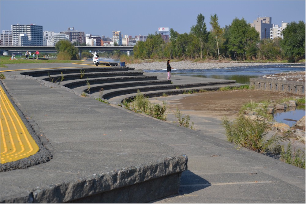
It's an amazing park. Slap bang in the middle of the city. Steps on either side which can be used any day it's not flooding...

Interesting concrete finishes on the river banks in some sections. But mostly great swathes of seating. This bunch - in the distance - having a BBQ Japanese style...

See what I mean....

You can really get lost down by the river. But so much informal surveillance from the river bank. One of the safest cities in the world...

Great places to sit and watch the river....

The group I was destined to meet with my daughter set up their BBQs in the middle distance...

Very sociable. In the middle of the city...

And a good time was had by all. Father bonding with daughter over Japan style BBQ...

And then home again on the bike. I was keen on these bronze fishes. So were the Japanese. They were even fishing in this river. I've put this blog up because it shows what a city the size of Auckland can do if it commits to central city public space commensurate with its population. We have the opportunity in Auckland of providing this kind of "World Class" public space on our CBD Waterfront. Or we can fill it up with buildings and cruise ships. I know what I'd like to see.

So. Here's our waterfront. The Quay Street Park - Auckland's equivalent of Sapporo's Odori Park - is shown here in the yellow rectangle. To just past Captain Cook wharf it's about 1500 metres long. But only about 30 metres wide (the width of Quay Street). A total area of 4.5 hectares. We need to make the most of this space. And not enclose parts of it into a canyon of buildings. Give Auckland a sense of space. And it needs to be connected to a Queens Wharf Park (area 2.5 hectares) that is an addition to Quay Park. Quay Park and Queens Park and Wynyard Park. That would show class, and commitment to a quality public park on Auckland's waterfront.