This Google image shows a fair chunk of the city of Kuala Lumpur, Malaysia. It is the most populous city region in Malaysia, with an estimated metropolitan population of 6.9 million as of 2007, and average population density of 2790 per square km. I had the fortune to Chair an International Integrated Transport Planning Conference there last week. Other posts will cover the conference. This post looks at the car-centric approach adopted in Kuala Lumpur. Reminiscent of Auckland.... In this pic the yellow lines indicate motorways and some large arterials. This Google image shows a fair chunk of the city of Kuala Lumpur, Malaysia. It is the most populous city region in Malaysia, with an estimated metropolitan population of 6.9 million as of 2007, and average population density of 2790 per square km. I had the fortune to Chair an International Integrated Transport Planning Conference there last week. Other posts will cover the conference. This post looks at the car-centric approach adopted in Kuala Lumpur. Reminiscent of Auckland.... In this pic the yellow lines indicate motorways and some large arterials.
|
 This pic is a bit closer to my "Transport Oriented Design" study area. You can see medium to a high density development cluster, ringed or at least surrounded by motorways. KL is said to be a "primate city". It is the leading city in its country, disproportionately larger than any others in the urban hierarchy. A 'primate city distribution' has one very large city with many much smaller cities and towns, and no intermediate-sized urban centres.... This pic is a bit closer to my "Transport Oriented Design" study area. You can see medium to a high density development cluster, ringed or at least surrounded by motorways. KL is said to be a "primate city". It is the leading city in its country, disproportionately larger than any others in the urban hierarchy. A 'primate city distribution' has one very large city with many much smaller cities and towns, and no intermediate-sized urban centres....
|
 This shows the study area. Significant motorway structures at the bottom, and high rise buildings in the top of the image. Highlighted is an urban arterial street at right angles to the motorways. Also shown is a rear access laneway, carpark access driveways, and an enclosed pedestrian environment... This shows the study area. Significant motorway structures at the bottom, and high rise buildings in the top of the image. Highlighted is an urban arterial street at right angles to the motorways. Also shown is a rear access laneway, carpark access driveways, and an enclosed pedestrian environment...
|
 This shows cars queued and turning into the highlighted street off the motorway exits.... This shows cars queued and turning into the highlighted street off the motorway exits....
|
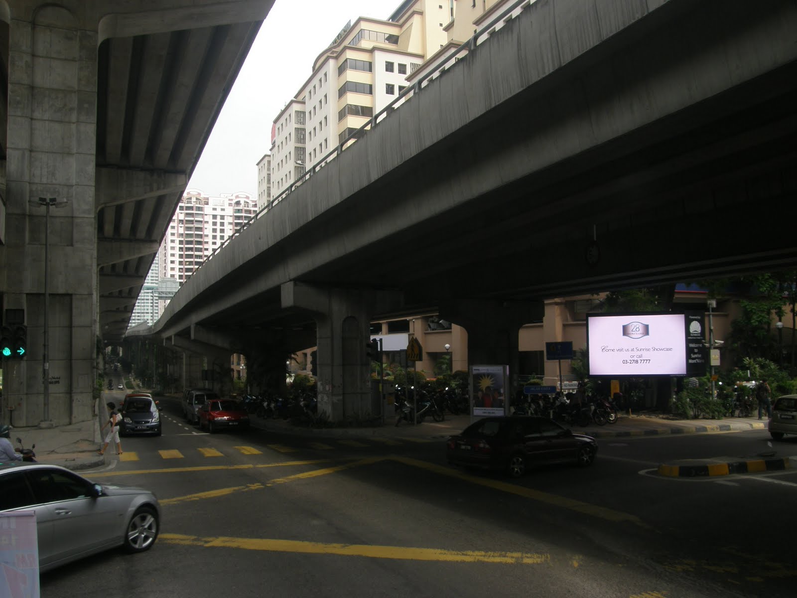
 The pedestrian environment underneath the motorway structures. Very noisy and fume laden. Poor provision for walkers with any sort of disability (like being old for example). The pedestrian environment underneath the motorway structures. Very noisy and fume laden. Poor provision for walkers with any sort of disability (like being old for example).
|
 More of the same, and you can look up the street a distance... More of the same, and you can look up the street a distance...
|
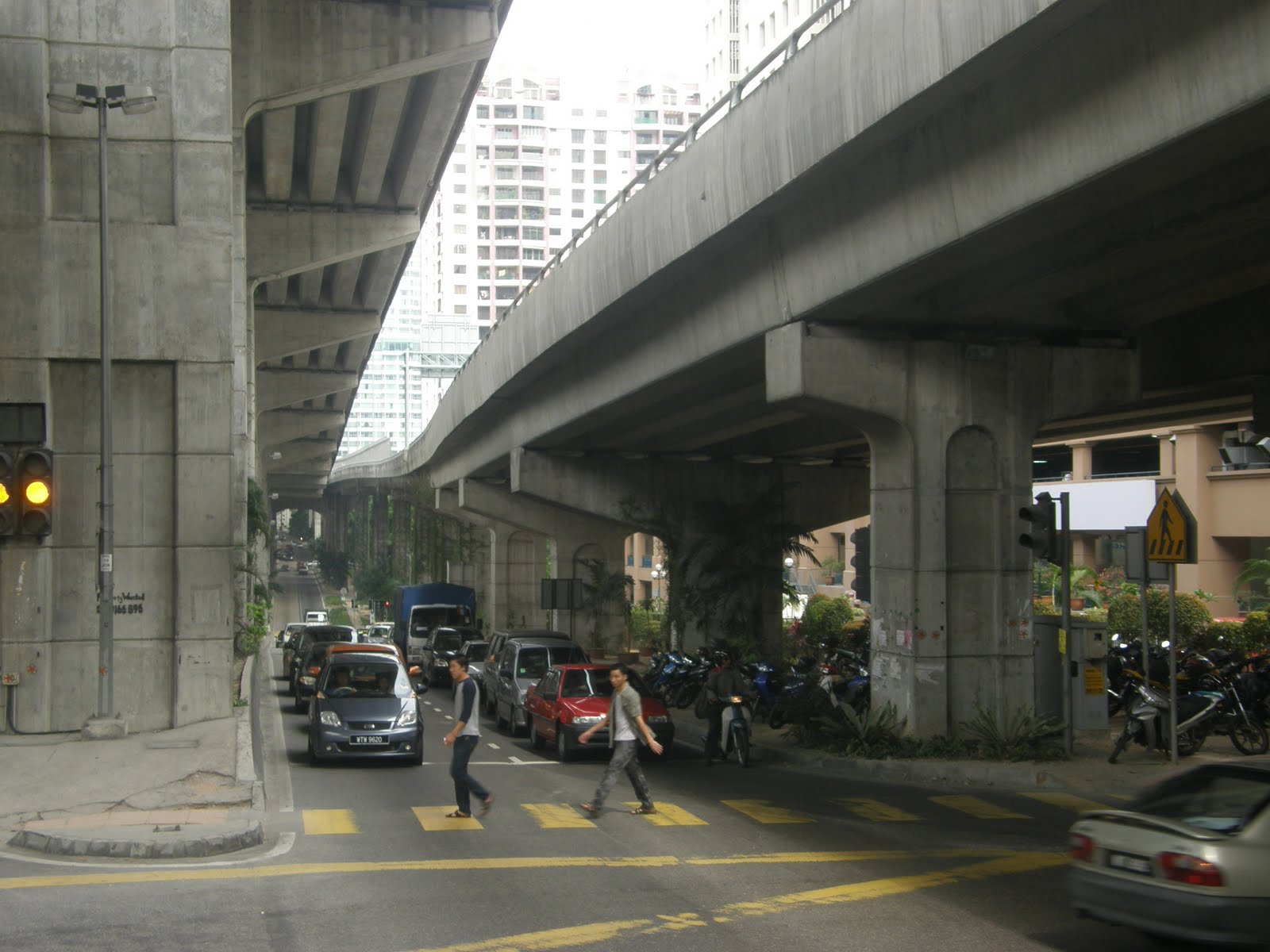
 These pedestrians wait cars accessing the arterial street. While there are a lot of pedestrian signs - their experience is hardly an inviting one. Just up the arterial street is a turnoff left to the rear access laneway.... These pedestrians wait cars accessing the arterial street. While there are a lot of pedestrian signs - their experience is hardly an inviting one. Just up the arterial street is a turnoff left to the rear access laneway....
|
 ...running off the street is this laneway access to the buildings for cars. It is almost unbelievable that the footpath to the left of the lane is dominated by potted plants. No pedestrian access along this lane... ...running off the street is this laneway access to the buildings for cars. It is almost unbelievable that the footpath to the left of the lane is dominated by potted plants. No pedestrian access along this lane...
|
 ...looking down the laneway we see a motorbike turning up one of the access driveways provided. You can see again how the footpath is taken up with potted plants... ...looking down the laneway we see a motorbike turning up one of the access driveways provided. You can see again how the footpath is taken up with potted plants...
|
 Car entry driveways are provided at convenient intervals along this laneway.... Car entry driveways are provided at convenient intervals along this laneway....
|
 This car is making its way up one of the driveways to access a carpark located in the office building where he/she works.... This car is making its way up one of the driveways to access a carpark located in the office building where he/she works....
|
 ...the driveways are of the standard of a lovely footpath, but are only for cars. The guards at the top prevent cars parking outside buildings. Cars are the priority... ...the driveways are of the standard of a lovely footpath, but are only for cars. The guards at the top prevent cars parking outside buildings. Cars are the priority...
|
 ...lovingly designed car driveway accessways into the buildings that make up this commercial complex. It is worth noting that there is no residential accommodation provided... ...lovingly designed car driveway accessways into the buildings that make up this commercial complex. It is worth noting that there is no residential accommodation provided...
|
 Pedestrian amenity has not been forgotten in this development however. This image shows the central pedestrian courtyard that stands in the middle of the 6 office tower buildings. It is a pleasant enough environment. A sort of residential cul-de-sac. But it has nothing to do with the street. It is disconnected from the street.... Pedestrian amenity has not been forgotten in this development however. This image shows the central pedestrian courtyard that stands in the middle of the 6 office tower buildings. It is a pleasant enough environment. A sort of residential cul-de-sac. But it has nothing to do with the street. It is disconnected from the street....
|
 Meanwhile, back out on that arterial street, this panorama gives an impression of the extent to which car access on and off this street is also provided for. This is to enable access to the street frontages of the buildings. This obviously compromises the pedestrian experience on the actual street whose footpaths are narrow, planted, and regularly interrupted with vehcle crossings which have priority. There is no bus service at all in this area of Kuala Lumpur, and no railway station for miles. It has been totally designed for car access. Meanwhile, back out on that arterial street, this panorama gives an impression of the extent to which car access on and off this street is also provided for. This is to enable access to the street frontages of the buildings. This obviously compromises the pedestrian experience on the actual street whose footpaths are narrow, planted, and regularly interrupted with vehcle crossings which have priority. There is no bus service at all in this area of Kuala Lumpur, and no railway station for miles. It has been totally designed for car access.
|
 And just to finish, near the case study area is this classic section of motorway where an exit wasn't properly provided, so a u'turn was provided. The case study is a logical extension of the private car culture. With complete separation between car traffic and pedestrian life. And if the roads were not always congested, and if petrol was cheap, and if fumes were not poisonous - it would be a rational approach. Interesting.... And just to finish, near the case study area is this classic section of motorway where an exit wasn't properly provided, so a u'turn was provided. The case study is a logical extension of the private car culture. With complete separation between car traffic and pedestrian life. And if the roads were not always congested, and if petrol was cheap, and if fumes were not poisonous - it would be a rational approach. Interesting....
|