|
|
|
|
|
|
|
|
|
|
|
|
|
|
|
|
|
Thursday, June 9, 2011
University Planners Connect Auckland Waterfront


Wednesday, April 20, 2011
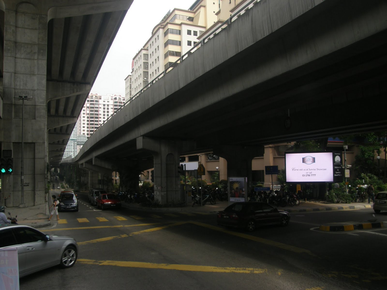
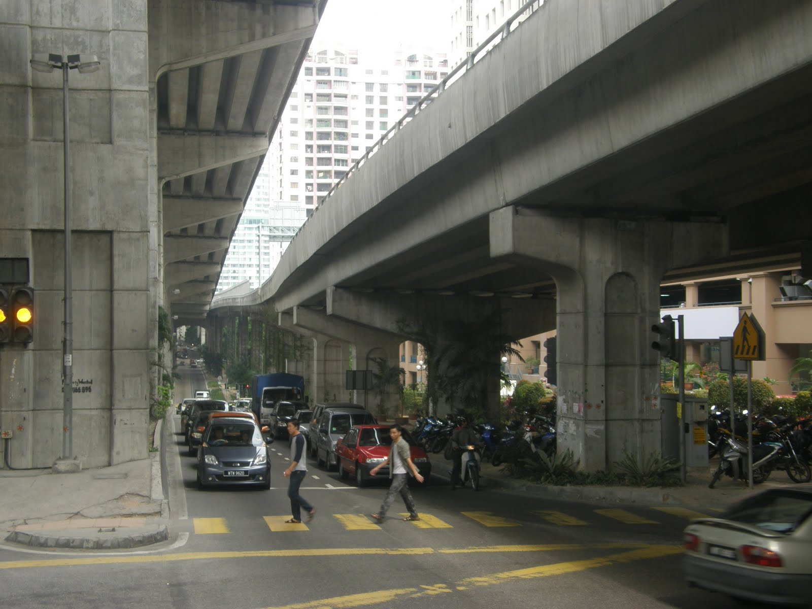
Kuala Lumpur Transport Oriented Design Study
|
|
|
|
|
|
|
|
|
|
|
|
|
|
|
|




Wednesday, October 14, 2009
Auckland might be getting TODs, but PODs are slow to come...
Here is Auckland, there is a head of steam up over TODs, we have the Northern Busway, and we have some successful rail infrastructure. Which needs electrification and extension and further development. That's all good. But public transport infrastructure needs to be linked into land uses to form a good TOD. There are a few of these in Auckland, but there's not been much in the way of PODs.
New Lynn and Newmarket are among the most successful TODs. Waitakere City Council has gone to exemplary lengths to get the New Lynn development up. This is a TOD (because you've got rail and bus services connecting there, and driving the development), but the council has also strived to make the whole environment pedestrian friendly by creating a trench for the rail and establishing more pedestrian oriented paths and spaces. It's not totally successful, because there is still - in my opinion - too much provision for the private car.
Newmarket is a pretty good TOD too. And its pedestrian environment is OK, but again, there is execessive emphasis on the car, and not enough on pedestrian and cycling amenity.
Auckland reaps what it sows.
Auckland's strategic documents don't really get to the core of what is needed to deliver PODs. I tried with the previous RLTS (the one that is active now), to get some policies in there about POD. And here is the salient policy from RLTS 2005:
3.1.6 Design transport connections within highNeedless to say, that sort of sentiment expressed in a single policy statement is all well and good, but it needed to be fleshed out somewhat. Easy to ignore. And at the time it would be safe to observe that officers were not full of ideas about this stuff either. Auckland is so far behind the eight ball on things like this.
density centres and corridors to give priority to
supporting pedestrians, cyclists and public transport
and to enable improved urban amenity and land
use integration, rather than to provide for the free
flow of vehicle traffic. (ARTA, TAs, Transit NZ,
OnTrack).
Anyway. Again at the RLTC I have raised the matter of the need to better integrate land use and transport policies - in order to deliver POD as well as TOD - arguing that Auckland transport strategies are too reliant on public transport alone to deliver the benefits and city shaping that is needed.....
I was asked, after the last RLTC to provide some feedback on how the new RLTS should be changed to better provide for POD thinking. So I dug back into that assignment and here is the advice that I have provided for consideration in this draft RLTS:
My contribution here is drawn from a paper I did earlier this year which you can find at:
http://www.joelcayford.com/AucklandsTransportCarbonEconomy.pdf
This material probably needs a bit of rationalisation and tidying, but gives an idea of where I think Auckland (and SuperCity) needs to be going if we seriously want to change the amenity, and public experience of our town centres.You will see in there, in terms of Transport Carbon Reduction - based on the work of VTPI (Victoria Transport Policy Institute - based in Canada - which is extracted and quoted in the paper), a region like Auckland can expect a 20% to 40% transport carbon reduction through ensuring that the transport/land use patterns of existing town centres, DOES shift to a much more pedestrian and cycling oriented transport pattern than now. But at present, my sense is that the policies in place in the RLTS and the performance targets, don't drive that outcome hard enough.
The key things I want to draw out, some of which may be in the current RLTS draft, include: Go back to the principles set out in the ARGS, including:
• Reduces the need to travel by car by encouraging more employment/business/retail/community facilities close to residential areas and the opportunity to walk or cycle. This pattern needs to foster a critical mass in terms of population to support a range of small local enterprises.
• …(the need to)…Enable a regional land use pattern where local areas have sufficient critical mass in terms of population to support a range of quality and accessible community facilities and services, including health facilities and education and training to support employment choice.Then, from the other end of the policy spectrum, the Long Term Sustainability Framework (LTSF) proposes a number of performance measures and targets which I think need to be built into the RLTS, so that there is real focus on delivery:
• Proportion of private motor vehicle travel compared to sustainable transport.
• Community resource accessibility index.
• Percentage of population within identified growth areas.
• Percentage of employment within identified growth areas.
• Fuel consumption per capita.
• Means of travel to work.
• Average length of journey to work.
• Percentage of population within 500 metres from a train station or transport hub.
• Activity mix in centres and pedestrian traffic (measure of vibrancy in centres).
• Total urban footprint and measures of land use (industrial, residential, business etc).
... while some of these relate more purely to land use, and might be better placed in the RPS, a good number of them are better placed in the RLTS, and lead to the desirable outcome that there be targets (5 year, 10 year, 20 year, 50 year) for these measures, which are indicative of the implementation of the principle of the ARGS. They can be added to, for example, by including a mode share set of targets as well.
In the Growing Smarter (GS) document, it is stated, as part of its assessment as to why the ARGS has not been happening on the ground, for example:
• Subdivision codes and traffic engineering codes and parking requirements are often in conflict with good urban design and TOD-type development…."GS goes on to state:
• To avoid the worst impacts of climate change and rising oil prices we need to rapidly reduce the use of carbon-based fuels, develop ways of recapturing carbon, facilitate a shift to the widespread use of renewable energy, and radically reduce energy use. Aucklanders will also need to significantly reduce their dependence on the private motor vehicle, and redevelop their urban form and rural centres into a compact urban form.
• The RLTS review needs to find ways to reduce CO2 emissions from the transport system.I note that in the current RLTS the "Emissions" appendix explains that one of the reasons for increased emissions is that under the strategy, people will actually take on average slightly longer trips: "Longer average vehicle trips are due to higher vehicle speeds. The combined effects of significantly more investment in roading, public transport and travel demand management, result in higher speeds, which allows people to travel further in the same time period…." . In part this is a consequence of not achieving the sort of urban form, density, and POD transport mix, that will cause a shift in this.
I have prepared a set of policy recommendations in the paper, which you can see at Chapter 5.
In retrospect, I think priority should be given in the RLTS, to bringing out the ITA (Integrated Transport Assessment) policy tool, and having it triggered earlier/lower down the hierarchy in the consenting process. It needs to include some of the targets and performance/assessment measures mentioned above. This would in part achieve better TOD outcomes, but needs also to drill down into the POD outcomes.
Finally, last but not least, I note that - for example NSCC (North Shore City Council) is reviewing its pavement/footpath strategy at present. But this all rests on the bedrock of "Infrastructure Design Standards Manual". The IDSM. This manual - and the engineering standards it enshrines, is the root of many of the anti-cycling and anti-pedestrian and pro-car outcomes that we see. In my view the RLTS needs to require a review of these IDSMs as they relate to Auckland Region's town centres, so that there is a shift in emphasis. The drive for this review is bring about a mode shift, by making pedestrian and cycling environment much more attractive and safer than now.
Wednesday, June 24, 2009
Wellington Waterfront - bridges to walk, places for shelter
 Wellington waterfront. Winter pictures. Bridge 1.
Walking around the waterfront it is striking and wonderful and fun to encounter so many bridges of different kinds. We like being over the water. Biking or walking...
 Wellington waterfront. Winter pictures. Bridge 2.
This is a simple lifting bridge. Elegant in design and operation.
 Wellington waterfront. Winter pictures. Bridge 3.
This multi-purpose bridge for bikes and pedestrians has a wind break down the middle. You can choose to walk with the wind, or in the lea...
 Wellington waterfront. Winter pictures. Bridge 4.
This wharf was separated from the main wharf, now linked with a multitude of small bridges. Easy access. Desire lines recognised. And no railings to mess things up...
 Wellington waterfront. Winter pictures. Bridge 5.
This speedy cycle and pedestrian bridge does have a railing. The bridge is narrow, carries a lot of slow traffic. And - as the sign says - is part of a working environment. Safety rules...
 Wellington waterfront. Winter pictures. Shelter 1.
It's windy in Wellington. In case you don't know. And it has been known to rain horizontally. Not to worry. Come to the waterfront and there's a shelter for you. These seats are positioned with screens behind. The screens are metal with holes - so you can see through, but rain and wind are all but stopped.
 Wellington waterfront. Winter pictures. Shelter 2.
This walkway can be exposed, so there's a wall to stop wind and rain, and if it's seriously bad, a little roof over your head...
 Wellington waterfront. Winter pictures. Shelter 3.
Here's a break in the Port's wrought iron fence, so you can get in, but while waiting the lights, there's a roof over your head...
Thursday, June 9, 2011
University Planners Connect Auckland Waterfront
|
|
|
|
|
|
|
|
|
|
|
|
|
|
|
|
|
Wednesday, April 20, 2011
Kuala Lumpur Transport Oriented Design Study
|
|
|
|
|
|
|
|
|
|
|
|
|
|
|
|
Wednesday, October 14, 2009
Auckland might be getting TODs, but PODs are slow to come...
Here is Auckland, there is a head of steam up over TODs, we have the Northern Busway, and we have some successful rail infrastructure. Which needs electrification and extension and further development. That's all good. But public transport infrastructure needs to be linked into land uses to form a good TOD. There are a few of these in Auckland, but there's not been much in the way of PODs.
New Lynn and Newmarket are among the most successful TODs. Waitakere City Council has gone to exemplary lengths to get the New Lynn development up. This is a TOD (because you've got rail and bus services connecting there, and driving the development), but the council has also strived to make the whole environment pedestrian friendly by creating a trench for the rail and establishing more pedestrian oriented paths and spaces. It's not totally successful, because there is still - in my opinion - too much provision for the private car.
Newmarket is a pretty good TOD too. And its pedestrian environment is OK, but again, there is execessive emphasis on the car, and not enough on pedestrian and cycling amenity.
Auckland reaps what it sows.
Auckland's strategic documents don't really get to the core of what is needed to deliver PODs. I tried with the previous RLTS (the one that is active now), to get some policies in there about POD. And here is the salient policy from RLTS 2005:
3.1.6 Design transport connections within highNeedless to say, that sort of sentiment expressed in a single policy statement is all well and good, but it needed to be fleshed out somewhat. Easy to ignore. And at the time it would be safe to observe that officers were not full of ideas about this stuff either. Auckland is so far behind the eight ball on things like this.
density centres and corridors to give priority to
supporting pedestrians, cyclists and public transport
and to enable improved urban amenity and land
use integration, rather than to provide for the free
flow of vehicle traffic. (ARTA, TAs, Transit NZ,
OnTrack).
Anyway. Again at the RLTC I have raised the matter of the need to better integrate land use and transport policies - in order to deliver POD as well as TOD - arguing that Auckland transport strategies are too reliant on public transport alone to deliver the benefits and city shaping that is needed.....
I was asked, after the last RLTC to provide some feedback on how the new RLTS should be changed to better provide for POD thinking. So I dug back into that assignment and here is the advice that I have provided for consideration in this draft RLTS:
My contribution here is drawn from a paper I did earlier this year which you can find at:
http://www.joelcayford.com/AucklandsTransportCarbonEconomy.pdf
This material probably needs a bit of rationalisation and tidying, but gives an idea of where I think Auckland (and SuperCity) needs to be going if we seriously want to change the amenity, and public experience of our town centres.You will see in there, in terms of Transport Carbon Reduction - based on the work of VTPI (Victoria Transport Policy Institute - based in Canada - which is extracted and quoted in the paper), a region like Auckland can expect a 20% to 40% transport carbon reduction through ensuring that the transport/land use patterns of existing town centres, DOES shift to a much more pedestrian and cycling oriented transport pattern than now. But at present, my sense is that the policies in place in the RLTS and the performance targets, don't drive that outcome hard enough.
The key things I want to draw out, some of which may be in the current RLTS draft, include: Go back to the principles set out in the ARGS, including:
• Reduces the need to travel by car by encouraging more employment/business/retail/community facilities close to residential areas and the opportunity to walk or cycle. This pattern needs to foster a critical mass in terms of population to support a range of small local enterprises.
• …(the need to)…Enable a regional land use pattern where local areas have sufficient critical mass in terms of population to support a range of quality and accessible community facilities and services, including health facilities and education and training to support employment choice.Then, from the other end of the policy spectrum, the Long Term Sustainability Framework (LTSF) proposes a number of performance measures and targets which I think need to be built into the RLTS, so that there is real focus on delivery:
• Proportion of private motor vehicle travel compared to sustainable transport.
• Community resource accessibility index.
• Percentage of population within identified growth areas.
• Percentage of employment within identified growth areas.
• Fuel consumption per capita.
• Means of travel to work.
• Average length of journey to work.
• Percentage of population within 500 metres from a train station or transport hub.
• Activity mix in centres and pedestrian traffic (measure of vibrancy in centres).
• Total urban footprint and measures of land use (industrial, residential, business etc).
... while some of these relate more purely to land use, and might be better placed in the RPS, a good number of them are better placed in the RLTS, and lead to the desirable outcome that there be targets (5 year, 10 year, 20 year, 50 year) for these measures, which are indicative of the implementation of the principle of the ARGS. They can be added to, for example, by including a mode share set of targets as well.
In the Growing Smarter (GS) document, it is stated, as part of its assessment as to why the ARGS has not been happening on the ground, for example:
• Subdivision codes and traffic engineering codes and parking requirements are often in conflict with good urban design and TOD-type development…."GS goes on to state:
• To avoid the worst impacts of climate change and rising oil prices we need to rapidly reduce the use of carbon-based fuels, develop ways of recapturing carbon, facilitate a shift to the widespread use of renewable energy, and radically reduce energy use. Aucklanders will also need to significantly reduce their dependence on the private motor vehicle, and redevelop their urban form and rural centres into a compact urban form.
• The RLTS review needs to find ways to reduce CO2 emissions from the transport system.I note that in the current RLTS the "Emissions" appendix explains that one of the reasons for increased emissions is that under the strategy, people will actually take on average slightly longer trips: "Longer average vehicle trips are due to higher vehicle speeds. The combined effects of significantly more investment in roading, public transport and travel demand management, result in higher speeds, which allows people to travel further in the same time period…." . In part this is a consequence of not achieving the sort of urban form, density, and POD transport mix, that will cause a shift in this.
I have prepared a set of policy recommendations in the paper, which you can see at Chapter 5.
In retrospect, I think priority should be given in the RLTS, to bringing out the ITA (Integrated Transport Assessment) policy tool, and having it triggered earlier/lower down the hierarchy in the consenting process. It needs to include some of the targets and performance/assessment measures mentioned above. This would in part achieve better TOD outcomes, but needs also to drill down into the POD outcomes.
Finally, last but not least, I note that - for example NSCC (North Shore City Council) is reviewing its pavement/footpath strategy at present. But this all rests on the bedrock of "Infrastructure Design Standards Manual". The IDSM. This manual - and the engineering standards it enshrines, is the root of many of the anti-cycling and anti-pedestrian and pro-car outcomes that we see. In my view the RLTS needs to require a review of these IDSMs as they relate to Auckland Region's town centres, so that there is a shift in emphasis. The drive for this review is bring about a mode shift, by making pedestrian and cycling environment much more attractive and safer than now.
Wednesday, June 24, 2009
Wellington Waterfront - bridges to walk, places for shelter
Wellington waterfront. Winter pictures. Bridge 1.Walking around the waterfront it is striking and wonderful and fun to encounter so many bridges of different kinds. We like being over the water. Biking or walking...
Wellington waterfront. Winter pictures. Bridge 2.This is a simple lifting bridge. Elegant in design and operation.
Wellington waterfront. Winter pictures. Bridge 3.This multi-purpose bridge for bikes and pedestrians has a wind break down the middle. You can choose to walk with the wind, or in the lea...
Wellington waterfront. Winter pictures. Bridge 4.This wharf was separated from the main wharf, now linked with a multitude of small bridges. Easy access. Desire lines recognised. And no railings to mess things up...
Wellington waterfront. Winter pictures. Bridge 5.This speedy cycle and pedestrian bridge does have a railing. The bridge is narrow, carries a lot of slow traffic. And - as the sign says - is part of a working environment. Safety rules...
Wellington waterfront. Winter pictures. Shelter 1.It's windy in Wellington. In case you don't know. And it has been known to rain horizontally. Not to worry. Come to the waterfront and there's a shelter for you. These seats are positioned with screens behind. The screens are metal with holes - so you can see through, but rain and wind are all but stopped.
Wellington waterfront. Winter pictures. Shelter 2.This walkway can be exposed, so there's a wall to stop wind and rain, and if it's seriously bad, a little roof over your head...
Wellington waterfront. Winter pictures. Shelter 3.Here's a break in the Port's wrought iron fence, so you can get in, but while waiting the lights, there's a roof over your head...




