The financial cost of the Christchurch earthquake has been huge and carefully valued, a disaster for many but an opportunity for economists and politicians alike who regard it as New Zealand’s best hope of achieving economic growth targets.
Last week the economics division at National Bank of New Zealand said, "four solid quarterly increases in economic activity have propelled Canterbury to the top of the year-on-year economic growth rankings", ahead of Auckland. The New Zealand Government’s recent budget relies heavily on economic activity in Christchurch to deliver GDP increases it believes are necessary to bring New Zealand’s economy into the black. As if all New Zealand needs is another disaster to keep on track.
Questions need to be asked about economic growth assumptions and about GDP – New Zealand’s commonly used measure of progress and success - because the same strategy is being applied by Councils in towns and cities with disastrous effects.
Kaipara District Council has achieved notoriety because of its proposal to almost double the rates of Mangawhai ratepayers to pay back the huge loan it raised to pay for a controversial sewage scheme.
Ratepayers were forced to abandon well maintained onsite wastewater systems which were generally working soundly, and then connect to the new wastewater network for a modest fee.
The original scheme raised a few eyebrows and might have succeeded. But, under pressure from developers and without consulting ratepayers further, the Council decided to double the land area serviced by the scheme, doubling the cost of the project. Now, because the predicted growth and development did not happen, the sewage scheme debt equates to an additional $20,000/residential ratepayer.
The Kaipara District Council 2009 - 2019 Long Term Council Community Plan gives some insights into how this happened: ‘The Kaipara District Council believes its key role in assisting the local economy to sustain and grow itself is to ensure the appropriate infrastructure is in place…’
While KDC’s investment in a sewage scheme might encourage growth in and around Mangawhai sometime in the future, it is questionable whether it is appropriate to levy the costs of that strategy now on existing ratepayers, by charging them an additional $2000/year - for the next ten years - on top of existing rates.
The investigative report now being condicted by the Office of the Auditor General will make interesting reading. Late last week, the Minister of Local Government- David Carter, announced it will appoint a Review Team to work with Kaipara District Council. This is very late in the day given Council must adopt its new plan and set the rates before the end of this month.
Still. Better late then never, though it will be too late to influence the potentially disastrous economic growth related decisions of Auckland Council.
Auckland Council’s Auckland Plan includes a diverse range of initiatives aimed at delivering a real GDP increase for Auckland of 5% /annum. This rate of growth is described in the Mayoral Forward to the Auckland Plan as “bold”. The services provided by the Council are said to: “support economic development of the region and contribute to the national economy”. The stated objective is to shift Auckland’s economic performance rating from 69th to 61st in OECD city rankings.
Last week Auckland Council media statements drew public attention to the fact that residential rates will increase by a gentle 3.6%, but quietly ignored its Ten Year Plan financial position statements which make for rather unhappy reading.
These show that council debt will balloon from $4.5 billion to $12.5 billion in ten years reaching almost $20,000/residential ratepayer. As bad as Mangawhai which is the worst in New Zealand. That debt will incur interest charges of more than $750 million each year – more than a quarter of the rates revenue for the Auckland region.
Auckland Council plans indicate that a number of big ticket projects would be funded from new loans. The City Centre Rail Loop project cost to ratepayers ranges from $1 billion to $3 billion over the next ten years, depending on whether the Government contributes its half of the cost, and how the project is staged. Auckland has needed this part of the rail network completed for decades. More than can be said about Watercare’s $800 million mega-sewage project that is to be bored under Auckland.
Even without these projects Auckland Council debt would still be $9 billion.
In its budget this year Central Government gave notice of its intention to reduce spending, though it is still borrowing heavily and government debt to GDP ratio is fast approaching 50%. Big ticket motorway projects apparently needed for growth are still provided for.
No such notice came from Auckland Council, despite signs that the growth much of its spending is for, is as illusory as it was in Mangawhai.
New Zealand’s population growth rate has dropped to the magic figure of 0.6% per annum due to emigration to Australia and other factors outside our control. Much of the population growth that Auckland is experiencing is due to internal migration. For example families are shifting to Auckland from Christchurch and other urban centres.
These shifts will cause Auckland’s economy to grow slowly, but they will cause other urban economies to shrink, leaving New Zealand’s overall economic position little changed.
Rather than chasing the tail of economic growth at all costs and incur enormous debt, the time has come to build economic resilience into New Zealand, to spend only what we earn, and to ensure urban living remains affordable for those who live here.
Showing posts with label Christchurch earthquake. Show all posts
Showing posts with label Christchurch earthquake. Show all posts
Monday, June 4, 2012
Tuesday, September 6, 2011
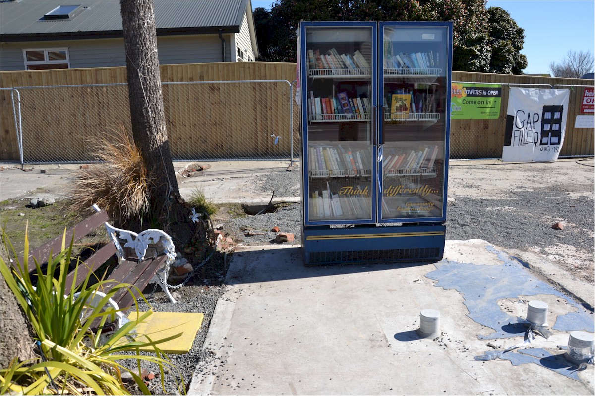
Filling Christchurch Gaps
|
|
|
|
|
|



Tuesday, July 12, 2011
Councils Fudge Christchurch Seismicity
There has been huge interest in the research I reported in my blog posting entitled Faulty Thinking About Christchurch. This research showed that work had been done in the late 1980's and early 1990's in New Zealand - by the Earthquake Commission and by the NZ Institute of Geological and Nuclear Science - about the risk of an earthquake event in Christchurch.
In particular this research warned that:
Indications are that the Christchurch seismic risk has been systematically minimised by both Environment Canterbury and Chriscthurch City Council.
Section 30(1)(c) of the RMA states:
In the Executive Summary of that OPUS report we read:
In fact, the clarity of the original Elder work done for EQC in 1991, which was based on 150 years of known earthquake history, gets lost in all this confusion. However the report does state: "Information of the North Canterbury fault and fold belt is noted to be limited..."
And that was that for the 2005 Opus report. It was as if oil had been poured on troubled water. Nothing else appears to have happened. Almost a case of "we don't really want to know what the seismic risk is here - otherwise we might have to do something about it...."
There are other interesting pieces of information on the ECan website. For example there is the 2008 Q-Files Earthquake Booklet, and there is an information packed sheet entitled: Solid Facts About Christchurch Liquefaction. While these are interesting, I don't consider that by themselves they fully discharge ECan's duties under the RMA.
I checked this by investigating ECan's Regional Policy Statement (RPS) which is where you would expect to find any policies that ECan has in respect of natural hazards and in particular - earthquakes. These are very long and challenging documents at the best of times, so I have been selective. Chapter 16 is about Natural Hazards. It begins with some promise:
My take on what happened is this: Figures of around $1 billion crop up in ECan thinking as the predicted cost of damage to Christchurch of an earthquake (compare with the actual estimated cost to date of earthquake damage of $20 billion). Combine this with preliminary Opus earthquake return predictions of every 475 years or every 900 years, and you can see that ECan's "cost-benefit" calculations would under-estimate the danger of the Christchurch seismic situation by a factor of 100 at least.
Clearly we need to plough on into the ECan RPS. To the next policy. To Policy 2:
Which brings me to Christchurch City Council's District Plan (CCCDP). Man oh man. You're doing well to get this far.
In the Issues for Christchurch section of the CCCDP, Section 3.4, Natural Hazards, we read:
Generally, as far as I could find, there are no liquefaction maps anywhere - though there now does appear to be some liquefaction reference on property LIM files. I am uncertain when that was implemented. This is private information. Does taht system constitute a "hazard register"?
You can search the CCCDP. I looked for liquefaction. It's only in the references I have already given above. You won't find it anywhere else. But it used to be scattered throughout the District Plan.
As you will see in the final case study (below) I wonder whether the Council paid any heed to its own plan, weakened as it is by a shakey earthquake risk assessment.
In my research I came across CCCDP Plan Change 28. This relates to a large chunk of land at Ferrymead.
I wonder what other changes have been made to Christchurch City Planning documents to remove references to the inconvenient truth that it has always been an earthquake prone city, ignoring the "build to the conditions" message that has been consistently delivered by consultants for the past two decades.
In particular this research warned that:
The purpose of this posting is to report what I have learned about the response of Christchurch Regional Council (Environment Canterbury) and of Christchurch City Council to these warnings, and how they have fulfilled their duties under the Resource Management Act (RMA).every 20 years, an earthquake of Modified Mercalli scale VII can be expected in Christchurch (slight damage in well-constructed buildings; slight to moderate in well-built ordinary structures; much damage in poorly constructed buildings; chimneys broken) and every 55 years an earthquake of Modified Mercalli scale VIII can be expected (Damage is still only slight in structures built to be earthquake-resistant; among substantial ordinary buildings there is much damage and some collapse. Poorly built buildings are substantially damaged. Tall things such as chimneys and monuments collapse. Heavy furniture is overturned).
Indications are that the Christchurch seismic risk has been systematically minimised by both Environment Canterbury and Chriscthurch City Council.
Section 30(1)(c) of the RMA states:
"Every Regional Council shall have the following functions for the purpose of giving effect to this Act in its region... the control of the use of land for the purpose of.... the avoidance or mitigation of natural hazards...."In Environment Canterbury's (ECan) website we read under a heading: "Earthquake Hazard and Risk Assessment Study" that:
Environment Canterbury needs to know the likely impact and consequences of a major earthquake on Christchurch, to fulfil its hazard mitigation and emergency management functions. Environment Canterbury considers that the earthquake hazard information currently available is generally of a standard and scale suitable for an earthquake risk assessment.This webpage goes on to describe work that was done for ECan by OPUS Consultants in 2005.
In the Executive Summary of that OPUS report we read:
A methodology has been developed to undertake an earthquake risk assessment for Christchurch. The approach has been based on generating risk information that meets the objectives of Environment Canterbury and provides a basis for organisations to undertake risk management actions.... An assessment of the risk from earthquakes to Christchurch will assist with the management of the risk, through reduction, readiness, response and recovery planning.Toward the end of the substantial report there are more than 20 recommendations, among which are these:
Environment Canterbury will be commissioning an earthquake risk assessment study for Christchurch. The objectives of such a risk assessment are to understand the likely impact and consequences of a major earthquake on Christchurch, to fulfil its hazard mitigation and emergency management functions, and provide information to stakeholders for them to fulfil their responsibilities under the Civil Defence Emergency Management Act. The following recommendations are made:As far as I can tell, none of these recommendations have been followed up. I repeat the sentence that is set out in ECan's website: "Environment Canterbury considers that the earthquake hazard information currently available is generally of a standard and scale suitable for an earthquake risk assessment." I read that as: don't call us, we'll call you.... But before I move on from that 2005 Opus report, I note some of the information and comments made in the body of the text about the risk of earthquake in Christchurch - based on a literature search:
(i) A risk assessment study be carried out as envisaged to provide information for risk management planning and implementation by Environment Canterbury, and other stakeholders.
vii) Three earthquake scenarios and a possible fourth scenario be used for the risk
assessment, to provide earthquake risk information to enable emergency response
planning for a range of scenarios. The fourth scenario of a hidden Canterbury
Plains Fault earthquake should be discussed with seismologists as part of the risk
assessment, to decide on the appropriateness for this study.
(ix) The liquefaction ground damage map for the Alpine Fault compiled for ECan be
extended to present liquefaction ground damage for earthquake scenarios.
xv) Casualties be assessed based on day time and night time population distributions, based primarily on building damage.
xxiii) The study be carried out based on a robust understanding of the performance of buildings and lifelines in earthquakes and the earthquake hazards affecting
Christchurch.
Beca Carter Hollings & Ferner (2004) report on the outcomes of the Christchurch Liquefaction Study for Environment Canterbury. Liquefaction maps are provided for two groundwater levels, and indicate high, moderate or low liquefaction potential, depending on whether liquefaction is likely in 0.12g, 0.2g or 0.34g earthquake shaking levels. (Ed: Anyone seen these maps?)And then the report gets buried in a morass of conflicting data about ground accelerations and spectral accelerations, and confusion between the effects of local and alpine fault originated earthquakes, but continues to assert "there remains the potential for “hidden” earthquake sources...". The Opus report does not appear to question the earthquake predictions of Elder, but there is much talk in the report of 475 year return period earthquakes and 1000 year return period earthquakes....
The Earthquake Hazard in Christchurch (Elder et al, 1991) presented a detailed evaluation of the earthquake hazards in Christchurch, and contributed to a significant advance in the knowledge of the earthquake hazards in the city. It considered earthquake fault sources, a prediction of the intensity of ground shaking (with associated probabilities and recurrence intervals) ... It also presented some generic comments on the potential damage to buildings and infrastructure. However, this did not provide a formal assessment of the risk....
Risks & Realities, a report of the Christchurch Engineering Lifelines Group (Centre for Advanced Engineering, 1997) presents a multi-disciplinary approach... It discusses three potential sources of earthquakes:
1. Moderately large to large earthquake in the Canterbury Foothills or North Canterbury
2. A very large earthquake on the Alpine Fault
3. Earthquakes centred close to Christchurch
The first two scenarios were considered to be capable of causing MM VIII to IX shaking intensities on the Modified Mercalli Scale, and the third MM VIII intensity.
The lifeline study adopted a 150-year return period earthquake with shaking intensities of MM VIII – IX over most of Christchurch. There was disagreement between researchers as to the expected intensity of shaking in a 150-year return period earthquake....
In fact, the clarity of the original Elder work done for EQC in 1991, which was based on 150 years of known earthquake history, gets lost in all this confusion. However the report does state: "Information of the North Canterbury fault and fold belt is noted to be limited..."
And that was that for the 2005 Opus report. It was as if oil had been poured on troubled water. Nothing else appears to have happened. Almost a case of "we don't really want to know what the seismic risk is here - otherwise we might have to do something about it...."
There are other interesting pieces of information on the ECan website. For example there is the 2008 Q-Files Earthquake Booklet, and there is an information packed sheet entitled: Solid Facts About Christchurch Liquefaction. While these are interesting, I don't consider that by themselves they fully discharge ECan's duties under the RMA.
I checked this by investigating ECan's Regional Policy Statement (RPS) which is where you would expect to find any policies that ECan has in respect of natural hazards and in particular - earthquakes. These are very long and challenging documents at the best of times, so I have been selective. Chapter 16 is about Natural Hazards. It begins with some promise:
Chapter 16 Natural Hazards.Sounds like a call for a risk assessment. But wait. There's more to be fair. Regional Policy Statements are required by the RMA to contain: objectives, policies and methods. So here's Objective 1:
Natural hazards in Canterbury can be ranked by the potential damage that could result, for example, taken on an annual basis. Limited information suggests that the most severe regionally significant natural hazards in the region are, in order of importance:
(1) Large magnitude earthquake affecting Christchurch.
(2) Extreme drought.
(3) Waimakariri River flooding of Christchurch and Kaiapoi.
(4) Major tsunami affecting southern Pegasus Bay and Banks Peninsula, or Timaru coastline.
Other natural occurrences of importance include flooding, fire, wind, snowfall, landslip, erosion and sedimentation (including dune build-up), but the relative impact of these, and what degree of management, if any, is warranted, has yet to be determined.
ECan RPS Chapter 16 Objective 1So. The guts of this appears to be that for this policy, earthquakes are not prioritised, but their effects are. (Presumably that would be why a risk assessment was thought to be needed at one time...) And that maybe Christchurch City Council has responsibility - but only if ECan's RPS states they have responsibility.
Avoid or mitigate the actual or potential costs of loss or damage to life, property, or other parts of the environment from natural hazards.
Principal Reasons
Natural hazards can result in loss or damage to people, property, or the environment. The aim of natural hazard management is to minimise the net cost of such damage.
Policy 1
In managing natural hazards, highest priority should be given to the combination of measures which delivers the greatest net benefit.
Explanation
Priority treatment of natural hazards is a policy of dealing first with those that offer the highest return on available investment. This is expressed in terms of protection gained and costs incurred, a notion embodied in the term used above - greatest net benefit. In the calculation of benefit, and of costs, both monetary and non-monetary values are included. Nonmonetary factors include effects on people, cultural values, ecosystems, landscape, and amenity. These values are taken into account by comparing alternative options. Although it is not possible to place a precise dollar value on any improvement in non-monetary benefit, methods are available for gauging whether or not the additional non-monetary benefit exceeds any added monetary cost.
Net benefit, then, is the sum of net monetary benefit, and net non-monetary benefit.
A natural hazard is the interaction or potential interaction between a natural occurrence and something of value to people (ie, assets).... Consistent with this, one natural occurrence may give rise to several natural hazards. A single flood for example, may affect some homes and their occupants, some farmland, a major bridge and an airfield. Each of these interactions is a separate natural hazard. Likewise a single earthquake may affect a main highway and a town.....
For the purposes of this policy, it is these six distinct natural hazards (interactions between a natural occurrence and people and their homes, farmland, a major bridge, airfield, highway and town), not the two hazard triggers (flood and earthquake), that are to be prioritised....
Principal Reasons
Resources for dealing with natural hazards are limited, and it is important to put that investment first in the places where it is likely to do most good.
Methods
1. The methods used or to be used by the Regional Council are:
(b) Regional plans
(d) Information provision
(f) Advocacy, promotion and co-operation
2. District/city councils in the preparation, variation, change, or review of district plans, through the exercise of their functions should, where their responsibilities for natural hazards are stated in this Regional Policy Statement, consider including provisions that:
(a) give highest priority to managing those natural hazards where the greatest net benefit can be delivered.
My take on what happened is this: Figures of around $1 billion crop up in ECan thinking as the predicted cost of damage to Christchurch of an earthquake (compare with the actual estimated cost to date of earthquake damage of $20 billion). Combine this with preliminary Opus earthquake return predictions of every 475 years or every 900 years, and you can see that ECan's "cost-benefit" calculations would under-estimate the danger of the Christchurch seismic situation by a factor of 100 at least.
Clearly we need to plough on into the ECan RPS. To the next policy. To Policy 2:
ECan RPS Chapter 16 Policy 2This is a remarkably convoluted policy. It appears to say that ECan has responsibility, unless its RPS states that Christchurch City Council has responsibility. But it's about as clear as mud to me whether ECan or Christchurch City Council shoulders RMA responsibility for earthquakes in Christchurch City. And then we get to Policy 3.
For the Canterbury region, or any part of the region, which local authority shall have responsibility within its own area for developing objectives, policies, and rules relating to the control of the use of land for the avoidance or mitigation of
natural hazards shall be determined in the following manner:
(a) Particular responsibility for any particular hazard or group of hazards shall initially remain with the local authority or local authorities managing that hazard or group of hazards as at 1 January 1994. Where this responsibility is not clear, the Regional Council shall retain primary responsibility....
Explanation
Natural occurrences that have a potential for adverse effects on people, property, and the environment come in many forms, among them earthquake, tsunami, erosion, landslip, wind, fire, drought, and flooding. Unless the Regional Policy Statement states which local authority or combination of local authorities is responsible for particular natural hazards, the Regional Council retains primary responsibility. Under this policy, the particular responsibility being undertaken initially remains with the local authority or local authorities managing the particular natural hazard at the time the policy was prepared. Subsequent to the Regional
Policy Statement becoming operative, the Regional Council will consult with territorial authorities in the region on any need for a re-allocation of natural hazard responsibilities, and may as a result prepare a change to the Regional Policy Statement.
“Managing” in the context of this policy includes taking particular responsibility for a particular hazard or group of hazards.
It should be noted that under the Building Act 1991, a building consent must be issued by a territorial authority, and that under the RM Act control of the subdivision of land is a function of territorial authorities.
Principal Reasons
To make clear for any particular natural hazard in Canterbury, how it is to be decided which should be dealt with by the Regional Council, and which by city and district councils.
Methods
1. The methods used or to be used by the Regional Council are:
(a) Responsibility for managing natural hazards
(g) Use of other legislation
ECan RPS Chapter 16 Policy 3Ok so this is about precaution. If no hazard management plans or strategies exist "...keep assets away from sources of danger...". This presumes knowledge of the sources of danger.
Where there is no provision for natural hazard in a plan relevant to an area in which an application for a resource consent has been received, the consent authority should, when having regard to this Regional Policy Statement, take a precautionary approach to the potential for a natural hazard to be created or increased as it relates to the applicant or any other person or property. This may be achieved by giving priority to the principle of avoidance.
Explanation
Many natural hazards have yet to be dealt with in plans or strategies, and many others are of such a localised or minor nature that they are never likely to be. The Regional Council and territorial authorities in the region, when considering applications for resource consents must, among other things, consider the possible natural hazard effects of granting such applications. This policy gives priority in those situations to keeping assets away from sources of danger.
Which brings me to Christchurch City Council's District Plan (CCCDP). Man oh man. You're doing well to get this far.
In the Issues for Christchurch section of the CCCDP, Section 3.4, Natural Hazards, we read:
CCCDP 3.4 Natural hazardsNothing particularly unexpected there. But the collective ECan and CCC is worrying. Continues the concern that here is an issue that is falling between two Council stools.
Within Christchurch there is risk from a number of natural hazards including:
• possible sea level rises;
• erosion of the coastline and rivers;
• erosion of the Port Hills;
• flooding from the rivers and the coast;
• damage caused by high winds;
• earthquakes; and
• fires in rural areas....
Both the Canterbury Regional Council and Council have responsibilities under the Act for control of the use of land for the avoidance or mitigation of natural hazards. The Regional Council has considerable knowledge about river and coastal processes that give rise to the major natural hazards. The Act requires the Council to hold records of areas subject to natural hazards and has considerable expertise in earthquake standards, flooding and erosion control measures....
CCCDP 3.4.5 Earthquake riskThat all rings fairly true. So what are the objectives, policies and methods for dealing with this issue? Well here they are:
Christchurch lies on the edge of a seismically active region. Consequently, earthquakes are likely to occur at a magnitude which will have major impacts on the City. In addition, there are other areas of active faults close to Christchurch, including Pegasus Bay, Porters Pass, Ashley and Mt Grey, Hope and Lake Heron.
The two main hazards which result from earthquakes are earth deformation (ground surface rupture) and earth shaking (liquefaction, land sliding, ground-cracking, tsunamis).
Strong shaking associated with either a close small magnitude earthquake, or a large magnitude distant event could cause considerable damage to the City, in particular in urban areas.
While single or two storey timber-framed residential dwellings are unlikely to suffer much structural damage in these events, in some areas liquefaction (where the solid ground takes on liquid qualities due to increased pressures) could cause distortion of buildings. Damage to buried cables, water and sewage pipes could also occur.
The most susceptible areas to liquefaction are those with water saturated, loose, well soiled silt and sand. It is also common in peaty soils. Large parts of the eastern suburbs and area around the Heathcote River are underlaid by these materials....
CCCDP 2.5 Objective : Natural hazardsThese words are all good, but little happens on the ground with these sorts of methods unless they are strongly enforced, monitored, and compliance measured. By contrast the methods adopted for flooding (rain - not liquefaction flooding) are extensive. The driver for the difference appears to be that earthquakes "hardly ever happen" (no surprise when you change the return period from 20 years to 475 years), while floods are frequent. Crude cost-benefit calculations complete the policy damage.
To avoid or mitigate the actual or potential adverse effects of loss or damage to life, property, or other parts of the environment from natural hazards.
Reasons
There are a number of potential natural hazards which can affect land within the City. These hazards include the following:
• Flooding from the Waimakariri River, or the river systems within the City, particularly the Heathcote.... etc etc and;
• Seismic activity and liquefaction; etc...
2.5.1 Policy : Presence of natural hazards
To control development within the City to protect life and investment, taking account of the presence of natural hazards and the degree of risk that those hazards impose on the environment.
Explanation and reasons
Natural hazards occur in varying degrees, and may cover greatly different areas.....It is not practicable, either through regulation or other means, to provide total security and protection from natural hazards. The protection of life and investment from natural hazards needs to take into account the likely risks as a result of natural hazards that may affect them. In undertaking measures which may involve intervention in the development or subdivision of land, the Council needs to provide a balance between economic and community needs and any proposals for land use controls, particularly where lower risk and the severity of likely impacts to property is apparent, and mitigation measures are effective and environmentally sound....
2.5.3 Policy : Earthquake
To ensure that buildings are constructed in a manner (or where appropriate, reconstructed) to ensure that their stability in times of earthquake is sufficient to avoid, or at least minimise, loss of life or damage to property.
Explanation and reasons
Christchurch is subject to a reasonably high level of risk from seismic activity and there are limitations to the degree of protection that can be provided from this hazard. However, there are provisions under the Building Act which ensure that new buildings are constructed to a standard which ensures that they have adequate resistance to seismic events. Where appropriate, existing buildings can be upgraded to provide a higher degree of protection. This latter matter has to be balanced however, after taking account of the Council's life safety obligations detailed in the Building Act, with recognition that some buildings would have to be demolished if protection to full earthquake standards were required, as the cost of upgrading would be uneconomic. The Council will in these circumstances take into account the potential land use activities and the risks to life within buildings of this nature, as well as the heritage values of buildings where this is appropriate.
Implementation
Objective 2.5 and associated policies will be implemented through a number of methods including the following...:
• Pattern of zoning that limits development of hazardous areas, e.g. South New Brighton Coastal Hazard Area;
• City rules for Subdivision and Development, including esplanade reserves or strips, and rules for natural and other hazards;
Other methods....:
• Provision of information, e.g. maintenance of information on the extent and location of hazards, (Council's Hazards Register).
• The provisions of the Building Act 2004, such as conditions on building resistance to seismic events.
Generally, as far as I could find, there are no liquefaction maps anywhere - though there now does appear to be some liquefaction reference on property LIM files. I am uncertain when that was implemented. This is private information. Does taht system constitute a "hazard register"?
You can search the CCCDP. I looked for liquefaction. It's only in the references I have already given above. You won't find it anywhere else. But it used to be scattered throughout the District Plan.
As you will see in the final case study (below) I wonder whether the Council paid any heed to its own plan, weakened as it is by a shakey earthquake risk assessment.
In my research I came across CCCDP Plan Change 28. This relates to a large chunk of land at Ferrymead.
|
|
|
|
|


Wednesday, July 6, 2011
Christchurch Earthquake Newspaper Archive
|
|
|
|


Sunday, June 26, 2011
Faulty Thinking About Christchurch
(NB: Since putting up this post, I have posted further research which you will be interested to read if you want to understand how Christchurch Council planning failed to manage the city's seismic risk: How Councils Under-Played Christchurch Seismic Risk.)... but read this one first....
Maybe I read the wrong newspapers, but around the time of the September earthquake in Christchurch, I got the impression that it came as a very big surprise to all concerned. I got the impression that people thought Christchurch was safe as houses as far as earthquakes went. Not quite the last place on earth for an earthquake, but low risk. Well. That was the impression I got from what I read, and from people I know who live there. How wrong I was.
My last blog on this subject reported a few of my speculative thoughts on the matter, and quoted from the abstract to research by the NZ Institute of Geological and Nuclear Science (NZIGNS), published in Environmental and Engineering Geoscience 1995, and entitled Geology of Christchurch.
It took a while to track down the actual report itself, but I found it buried within the Serials section of the General Library at Auckland University. There are 61 pages of it covering many aspects of the geology of Christchurch and a detailed section on the risk of earthquakes there.
Maybe I read the wrong newspapers, but around the time of the September earthquake in Christchurch, I got the impression that it came as a very big surprise to all concerned. I got the impression that people thought Christchurch was safe as houses as far as earthquakes went. Not quite the last place on earth for an earthquake, but low risk. Well. That was the impression I got from what I read, and from people I know who live there. How wrong I was.
My last blog on this subject reported a few of my speculative thoughts on the matter, and quoted from the abstract to research by the NZ Institute of Geological and Nuclear Science (NZIGNS), published in Environmental and Engineering Geoscience 1995, and entitled Geology of Christchurch.
It took a while to track down the actual report itself, but I found it buried within the Serials section of the General Library at Auckland University. There are 61 pages of it covering many aspects of the geology of Christchurch and a detailed section on the risk of earthquakes there.
|
The NZIGNS report tabulates 59 earthquakes that were “felt in Christchurch” between 1946 and 1994 (9 of these were centered outside the central South Island). Interestingly, the report tabulates the intensity of these earthquakes within Christchurch in terms of the Modified Mercalli Scale and the Richter Scale. Modified Mercalli ScaleOf the 59 earthquakes “felt in Christchurch” between 1946 and 1994, 47 were MMIV in intensity (ie IV on the Modified Mercalli Scale), 9 were MMV, and there was a MMVII (this was the 8 March 1987 earthquake centred in Pegasus Bay.) (By the way - my understanding of the damage caused by the recent earthquakes in Christchurch that these range between MMVII and MMIX in intensity, according to the Mercalli Scale. Parts of Christchurch were harder hit than others.) The NZIGNS report (dated 1995 remember) states: “Dibble and others consider the 5 June 1869 New Brighton earthquake to have been the most destructive since European settlement. This earthquake is estimated to have produced intensities of MMVII-MMVIII at Christchurch, and reports of the observed effects are consistent with an M5.75 earthquake (Richter Scale) located 10 miles from the city centre…” (NB: the nave of Christchurch Cathedral was not built until 1881.) I found these reports about that earthquake and one that came shortly after: 5 June 1869: Earthquake in early ChristchurchOn 5 June 1869, Christchurch settlers were shaken by an earthquake centred beneath the city, possibly around Addington or Spreydon. The earthquake was probably shallow, with a magnitude of about 5.8. There was damage to stone buildings and the spire of St John’s Church on Latimer Square, and many fallen chimneys. The quake may have caused some ground settlement in the Heathcote Estuary, as locals describe the tide as running higher up the Heathcote River afterward.Anyway, getting back to the NZIGNS report. It goes on to consider the risk of liquefaction, and reports past liquefaction events in these terms: “…Only one instance of liquefaction during an earthquake is recorded from the Christchurch area. This was for a magnitude M6-7.5 earthquake which occurred on 16 November 1901 (intensity MMIX in Christchurch) centred near Cheviot in north Canterbury…. ‘it was reported in The Press that at Kaiapoi the earthquakes of the 16th inst.were felt with great violence; that at some places the earth opened and water and sand were emitted from vents in the ground and that at one time an inundation by water from this source was apprehended…’” |
“A terrible earthquake occurred at 7.45 this morning, travelling direct from, east to west. It lasted several minutes. There is not a brick building or chimney left standing. The windows in many houses were shattered to atoms. One little child was killed by a falling house. The bakers' ovens are broken to pieces, and everything in the district is a complete wreck….” |
“…When first shock had passed, Mr. W. Waites, who owns an orchard and garden at the end of Charles and Sewell streets, noticed that his land was' apparently flooding from springs having been opened. It was then discovered that across his land, and part of Mr. Dunn's section, and over the surface of a paddock of several acres held by Mr. J. Sims, fissures from 1in to 3in in. width, and several chains in length, had opened… From these earthquake openings the water was freely issuing in such volume as to cause… probable inundation. Fortunately the rapid expansion of water seemed to be checked by a liberal supply of sand from some grey quicksand layer below the level of the river, and this was deposited in the orchard and elsewhere in the shape of round and oval porridge pots… The water, which had risen about six inches in on hour or two, disappeared by percolation, leaving the sand deposits in different fantastic forms….” |
“some of the Christchurch metropolitan area is underlain by similar materials, particularly large parts of the eastern suburbs and areas adjacent to the Heathcote River… Interbedded gravels are thinnest or absent in the central and eastern area of Christchurch where liquefaction effects and ground deformations (settlement and lateral spreading) are expected to be greatest…” |
|
|
|
|
The EQC report summary notes that the available data (covering the earlier earthquake events that are described above) is short, making it difficult to provide reliable predictions, given that the best predictor for the future is what has happened in the past. It states: The EQC Seismic Risk Assessment for Christchurch is dated 1991. Twenty years ago. |


Tuesday, March 29, 2011
How Strong was the Christchurch Earthquake?
|
|
|
|
|
|
|
|
|


Wednesday, March 2, 2011
Garden City’s Cheeky Opportunity
New Zealand’s Garden City has the opportunity to re-invent itself from the bottom up.
I’m talking sewage.
Consider the large amount of clean water that is used to carry even a small quantity of human excreta. With each flush, over 10 litres of clean water goes down the drain. This clean water which is flushed down the toilet goes into a traditional sewage system. We reticulate all sewage solids and wastewater in a big network of ceramic pipes for centralised treatment. The Romans had the idea for that first and it was perfected by the British almost 200 years ago. It’s ancient.
In the absence of government support or massive rates, traditional sewage solutions threaten to bankrupt communities. Especially if sewer networks need to be rebuilt.
Traditional sewage systems are atrociously expensive to build today primarily because of the labour intensive drainage network. Sewage treatment plants themselves are relatively cheap. It’s the thousands of kilometres of pipes that cost seriously big money. And where pipes are laid in ground that moves – forget shakes – cracks open up in the pipes letting rainwater in and causing overflows, and letting sewage out polluting more water — invariably rivers and ponds and beachwater.
For more than a decade – as a Councillor - I have immersed myself in Auckland’s sewage problems, projects and costs. I chaired North Shore City Council’s Works & Environment Committee’s recommendation ten years ago to impose a fixed charge per ratepayer of $500 annually to reduce leaks from the city’s fragile sewer network. We debated the issue at length. I suggested – half in jest – that we’d be better off with old style night-cart collection of excreta, central composting, and recycling back to land. At least we’d know it was being collected, and we’d also know it wouldn’t end up on the beaches.
North Shore City ratepayers have invested close to a billion dollars in its sewage system. And it still leaks. Much of Auckland is built on soft Waitemata clays and sandstone. It’s shifting slowly all the time, cracking the sewer network. The damage is slow but it’s relentless. And so are the repairs and the costs.
Much of Christchurch is built on alluvial gravels and sand. Its sewer networks lie in ditches dug into this substrate which liquefies in even a small earthquake. Given the choice of developing Christchurch today as a greenfield site – subject to earthquakes from time to time - engineers today would surely advise against a ceramic pipe based wastewater network.
Ten years ago the Auditor General concluded that “it is difficult for Thames Coromandel District Council to demonstrate that the sewage reticulation option is indeed the best use of ratepayer’s funds.” That report was part of a long running battle between the majority of Cooks Beach lot owners and a Council determined to fix septic tank problems by imposing a traditional reticulated sewage scheme. I know Christchurch City is not like Cooks Beach.
My interest in sewage alternatives has taken me round the world and times have changed, as Sydney Water found when it investigated developments in the United States and Europe, after facing estimates of between $16,000 and $70,000 per lot to connect houses to new centralised sewage systems.
They found that on site wastewater services are used in 50% of lots in Norway and 25% of all lots in the USA. On-site servicing is no longer seen as a temporary measure in the USA where 35% of new city housing developments are now on-site serviced. Beverley Hills in LA is all on-site, and Barbra Streisand was one who lobbied the council to keep it that way. The US Environmental Protection Agency has advised the US government that “decentralised systems, where properly managed, could protect water quality over the long term and do so at lower cost than conventional systems in many communities.”
The most modern systems used in US urban environments combine sophisticated on-site primary treatment tanks, which retain and biodigest solids and need emptying every ten years or so, and small-gauge leak-proof pipes which reticulate the liquid effluent only, to either a centralised treatment plant, or to small local treatment facilities. Some of these use vacuum systems or small pumps to send effluent through leak-proof plastic pipes which can bend and move with ground movement.
While modern centralised wastewater treatment plants in New Zealand are using cleaner technology, the fact is that traditional sewage reticulation pipe networks are dreadfully leaky, and environmental disasters in themselves. Even without an earthquake.
It is difficult to justify their construction and use in coastal environments if the goal is to protect and preserve water quality in the long term.
It is no longer flush it and forget it in Christchurch. Every day people are faced with the personal challenge of what to do with their own, and their children’s excrement. Call it human bio-solids. Right now a system of Portaloos and regular collection is being rolled out across Christchurch.
The collected bio-solids will contain toilet paper and some sterile urine. But will not be contaminated with heavy metal trade wastes that get tipped into the sewer. It will not be diluted with thousands of litres of water. It will be pure. Ripe for composting and re-use. It can be developed into a modern, resilient and responsible sanitation system.
Christchurch has the opportunity to re-invent itself from the bottom up.
I’m talking sewage.
Consider the large amount of clean water that is used to carry even a small quantity of human excreta. With each flush, over 10 litres of clean water goes down the drain. This clean water which is flushed down the toilet goes into a traditional sewage system. We reticulate all sewage solids and wastewater in a big network of ceramic pipes for centralised treatment. The Romans had the idea for that first and it was perfected by the British almost 200 years ago. It’s ancient.
In the absence of government support or massive rates, traditional sewage solutions threaten to bankrupt communities. Especially if sewer networks need to be rebuilt.
Traditional sewage systems are atrociously expensive to build today primarily because of the labour intensive drainage network. Sewage treatment plants themselves are relatively cheap. It’s the thousands of kilometres of pipes that cost seriously big money. And where pipes are laid in ground that moves – forget shakes – cracks open up in the pipes letting rainwater in and causing overflows, and letting sewage out polluting more water — invariably rivers and ponds and beachwater.
For more than a decade – as a Councillor - I have immersed myself in Auckland’s sewage problems, projects and costs. I chaired North Shore City Council’s Works & Environment Committee’s recommendation ten years ago to impose a fixed charge per ratepayer of $500 annually to reduce leaks from the city’s fragile sewer network. We debated the issue at length. I suggested – half in jest – that we’d be better off with old style night-cart collection of excreta, central composting, and recycling back to land. At least we’d know it was being collected, and we’d also know it wouldn’t end up on the beaches.
North Shore City ratepayers have invested close to a billion dollars in its sewage system. And it still leaks. Much of Auckland is built on soft Waitemata clays and sandstone. It’s shifting slowly all the time, cracking the sewer network. The damage is slow but it’s relentless. And so are the repairs and the costs.
Much of Christchurch is built on alluvial gravels and sand. Its sewer networks lie in ditches dug into this substrate which liquefies in even a small earthquake. Given the choice of developing Christchurch today as a greenfield site – subject to earthquakes from time to time - engineers today would surely advise against a ceramic pipe based wastewater network.
Ten years ago the Auditor General concluded that “it is difficult for Thames Coromandel District Council to demonstrate that the sewage reticulation option is indeed the best use of ratepayer’s funds.” That report was part of a long running battle between the majority of Cooks Beach lot owners and a Council determined to fix septic tank problems by imposing a traditional reticulated sewage scheme. I know Christchurch City is not like Cooks Beach.
My interest in sewage alternatives has taken me round the world and times have changed, as Sydney Water found when it investigated developments in the United States and Europe, after facing estimates of between $16,000 and $70,000 per lot to connect houses to new centralised sewage systems.
They found that on site wastewater services are used in 50% of lots in Norway and 25% of all lots in the USA. On-site servicing is no longer seen as a temporary measure in the USA where 35% of new city housing developments are now on-site serviced. Beverley Hills in LA is all on-site, and Barbra Streisand was one who lobbied the council to keep it that way. The US Environmental Protection Agency has advised the US government that “decentralised systems, where properly managed, could protect water quality over the long term and do so at lower cost than conventional systems in many communities.”
The most modern systems used in US urban environments combine sophisticated on-site primary treatment tanks, which retain and biodigest solids and need emptying every ten years or so, and small-gauge leak-proof pipes which reticulate the liquid effluent only, to either a centralised treatment plant, or to small local treatment facilities. Some of these use vacuum systems or small pumps to send effluent through leak-proof plastic pipes which can bend and move with ground movement.
While modern centralised wastewater treatment plants in New Zealand are using cleaner technology, the fact is that traditional sewage reticulation pipe networks are dreadfully leaky, and environmental disasters in themselves. Even without an earthquake.
It is difficult to justify their construction and use in coastal environments if the goal is to protect and preserve water quality in the long term.
It is no longer flush it and forget it in Christchurch. Every day people are faced with the personal challenge of what to do with their own, and their children’s excrement. Call it human bio-solids. Right now a system of Portaloos and regular collection is being rolled out across Christchurch.
The collected bio-solids will contain toilet paper and some sterile urine. But will not be contaminated with heavy metal trade wastes that get tipped into the sewer. It will not be diluted with thousands of litres of water. It will be pure. Ripe for composting and re-use. It can be developed into a modern, resilient and responsible sanitation system.
Christchurch has the opportunity to re-invent itself from the bottom up.
Subscribe to:
Posts (Atom)
Showing posts with label Christchurch earthquake. Show all posts
Showing posts with label Christchurch earthquake. Show all posts
Monday, June 4, 2012
Economic Growth Projects Disasters for NZ Communities
The financial cost of the Christchurch earthquake has been huge and carefully valued, a disaster for many but an opportunity for economists and politicians alike who regard it as New Zealand’s best hope of achieving economic growth targets.
Last week the economics division at National Bank of New Zealand said, "four solid quarterly increases in economic activity have propelled Canterbury to the top of the year-on-year economic growth rankings", ahead of Auckland. The New Zealand Government’s recent budget relies heavily on economic activity in Christchurch to deliver GDP increases it believes are necessary to bring New Zealand’s economy into the black. As if all New Zealand needs is another disaster to keep on track.
Questions need to be asked about economic growth assumptions and about GDP – New Zealand’s commonly used measure of progress and success - because the same strategy is being applied by Councils in towns and cities with disastrous effects.
Kaipara District Council has achieved notoriety because of its proposal to almost double the rates of Mangawhai ratepayers to pay back the huge loan it raised to pay for a controversial sewage scheme.
Ratepayers were forced to abandon well maintained onsite wastewater systems which were generally working soundly, and then connect to the new wastewater network for a modest fee.
The original scheme raised a few eyebrows and might have succeeded. But, under pressure from developers and without consulting ratepayers further, the Council decided to double the land area serviced by the scheme, doubling the cost of the project. Now, because the predicted growth and development did not happen, the sewage scheme debt equates to an additional $20,000/residential ratepayer.
The Kaipara District Council 2009 - 2019 Long Term Council Community Plan gives some insights into how this happened: ‘The Kaipara District Council believes its key role in assisting the local economy to sustain and grow itself is to ensure the appropriate infrastructure is in place…’
While KDC’s investment in a sewage scheme might encourage growth in and around Mangawhai sometime in the future, it is questionable whether it is appropriate to levy the costs of that strategy now on existing ratepayers, by charging them an additional $2000/year - for the next ten years - on top of existing rates.
The investigative report now being condicted by the Office of the Auditor General will make interesting reading. Late last week, the Minister of Local Government- David Carter, announced it will appoint a Review Team to work with Kaipara District Council. This is very late in the day given Council must adopt its new plan and set the rates before the end of this month.
Still. Better late then never, though it will be too late to influence the potentially disastrous economic growth related decisions of Auckland Council.
Auckland Council’s Auckland Plan includes a diverse range of initiatives aimed at delivering a real GDP increase for Auckland of 5% /annum. This rate of growth is described in the Mayoral Forward to the Auckland Plan as “bold”. The services provided by the Council are said to: “support economic development of the region and contribute to the national economy”. The stated objective is to shift Auckland’s economic performance rating from 69th to 61st in OECD city rankings.
Last week Auckland Council media statements drew public attention to the fact that residential rates will increase by a gentle 3.6%, but quietly ignored its Ten Year Plan financial position statements which make for rather unhappy reading.
These show that council debt will balloon from $4.5 billion to $12.5 billion in ten years reaching almost $20,000/residential ratepayer. As bad as Mangawhai which is the worst in New Zealand. That debt will incur interest charges of more than $750 million each year – more than a quarter of the rates revenue for the Auckland region.
Auckland Council plans indicate that a number of big ticket projects would be funded from new loans. The City Centre Rail Loop project cost to ratepayers ranges from $1 billion to $3 billion over the next ten years, depending on whether the Government contributes its half of the cost, and how the project is staged. Auckland has needed this part of the rail network completed for decades. More than can be said about Watercare’s $800 million mega-sewage project that is to be bored under Auckland.
Even without these projects Auckland Council debt would still be $9 billion.
In its budget this year Central Government gave notice of its intention to reduce spending, though it is still borrowing heavily and government debt to GDP ratio is fast approaching 50%. Big ticket motorway projects apparently needed for growth are still provided for.
No such notice came from Auckland Council, despite signs that the growth much of its spending is for, is as illusory as it was in Mangawhai.
New Zealand’s population growth rate has dropped to the magic figure of 0.6% per annum due to emigration to Australia and other factors outside our control. Much of the population growth that Auckland is experiencing is due to internal migration. For example families are shifting to Auckland from Christchurch and other urban centres.
These shifts will cause Auckland’s economy to grow slowly, but they will cause other urban economies to shrink, leaving New Zealand’s overall economic position little changed.
Rather than chasing the tail of economic growth at all costs and incur enormous debt, the time has come to build economic resilience into New Zealand, to spend only what we earn, and to ensure urban living remains affordable for those who live here.
Last week the economics division at National Bank of New Zealand said, "four solid quarterly increases in economic activity have propelled Canterbury to the top of the year-on-year economic growth rankings", ahead of Auckland. The New Zealand Government’s recent budget relies heavily on economic activity in Christchurch to deliver GDP increases it believes are necessary to bring New Zealand’s economy into the black. As if all New Zealand needs is another disaster to keep on track.
Questions need to be asked about economic growth assumptions and about GDP – New Zealand’s commonly used measure of progress and success - because the same strategy is being applied by Councils in towns and cities with disastrous effects.
Kaipara District Council has achieved notoriety because of its proposal to almost double the rates of Mangawhai ratepayers to pay back the huge loan it raised to pay for a controversial sewage scheme.
Ratepayers were forced to abandon well maintained onsite wastewater systems which were generally working soundly, and then connect to the new wastewater network for a modest fee.
The original scheme raised a few eyebrows and might have succeeded. But, under pressure from developers and without consulting ratepayers further, the Council decided to double the land area serviced by the scheme, doubling the cost of the project. Now, because the predicted growth and development did not happen, the sewage scheme debt equates to an additional $20,000/residential ratepayer.
The Kaipara District Council 2009 - 2019 Long Term Council Community Plan gives some insights into how this happened: ‘The Kaipara District Council believes its key role in assisting the local economy to sustain and grow itself is to ensure the appropriate infrastructure is in place…’
While KDC’s investment in a sewage scheme might encourage growth in and around Mangawhai sometime in the future, it is questionable whether it is appropriate to levy the costs of that strategy now on existing ratepayers, by charging them an additional $2000/year - for the next ten years - on top of existing rates.
The investigative report now being condicted by the Office of the Auditor General will make interesting reading. Late last week, the Minister of Local Government- David Carter, announced it will appoint a Review Team to work with Kaipara District Council. This is very late in the day given Council must adopt its new plan and set the rates before the end of this month.
Still. Better late then never, though it will be too late to influence the potentially disastrous economic growth related decisions of Auckland Council.
Auckland Council’s Auckland Plan includes a diverse range of initiatives aimed at delivering a real GDP increase for Auckland of 5% /annum. This rate of growth is described in the Mayoral Forward to the Auckland Plan as “bold”. The services provided by the Council are said to: “support economic development of the region and contribute to the national economy”. The stated objective is to shift Auckland’s economic performance rating from 69th to 61st in OECD city rankings.
Last week Auckland Council media statements drew public attention to the fact that residential rates will increase by a gentle 3.6%, but quietly ignored its Ten Year Plan financial position statements which make for rather unhappy reading.
These show that council debt will balloon from $4.5 billion to $12.5 billion in ten years reaching almost $20,000/residential ratepayer. As bad as Mangawhai which is the worst in New Zealand. That debt will incur interest charges of more than $750 million each year – more than a quarter of the rates revenue for the Auckland region.
Auckland Council plans indicate that a number of big ticket projects would be funded from new loans. The City Centre Rail Loop project cost to ratepayers ranges from $1 billion to $3 billion over the next ten years, depending on whether the Government contributes its half of the cost, and how the project is staged. Auckland has needed this part of the rail network completed for decades. More than can be said about Watercare’s $800 million mega-sewage project that is to be bored under Auckland.
Even without these projects Auckland Council debt would still be $9 billion.
In its budget this year Central Government gave notice of its intention to reduce spending, though it is still borrowing heavily and government debt to GDP ratio is fast approaching 50%. Big ticket motorway projects apparently needed for growth are still provided for.
No such notice came from Auckland Council, despite signs that the growth much of its spending is for, is as illusory as it was in Mangawhai.
New Zealand’s population growth rate has dropped to the magic figure of 0.6% per annum due to emigration to Australia and other factors outside our control. Much of the population growth that Auckland is experiencing is due to internal migration. For example families are shifting to Auckland from Christchurch and other urban centres.
These shifts will cause Auckland’s economy to grow slowly, but they will cause other urban economies to shrink, leaving New Zealand’s overall economic position little changed.
Rather than chasing the tail of economic growth at all costs and incur enormous debt, the time has come to build economic resilience into New Zealand, to spend only what we earn, and to ensure urban living remains affordable for those who live here.
Tuesday, September 6, 2011
Filling Christchurch Gaps
|
|
|
|
|
|
Tuesday, July 12, 2011
Councils Fudge Christchurch Seismicity
There has been huge interest in the research I reported in my blog posting entitled Faulty Thinking About Christchurch. This research showed that work had been done in the late 1980's and early 1990's in New Zealand - by the Earthquake Commission and by the NZ Institute of Geological and Nuclear Science - about the risk of an earthquake event in Christchurch.
In particular this research warned that:
Indications are that the Christchurch seismic risk has been systematically minimised by both Environment Canterbury and Chriscthurch City Council.
Section 30(1)(c) of the RMA states:
In the Executive Summary of that OPUS report we read:
In fact, the clarity of the original Elder work done for EQC in 1991, which was based on 150 years of known earthquake history, gets lost in all this confusion. However the report does state: "Information of the North Canterbury fault and fold belt is noted to be limited..."
And that was that for the 2005 Opus report. It was as if oil had been poured on troubled water. Nothing else appears to have happened. Almost a case of "we don't really want to know what the seismic risk is here - otherwise we might have to do something about it...."
There are other interesting pieces of information on the ECan website. For example there is the 2008 Q-Files Earthquake Booklet, and there is an information packed sheet entitled: Solid Facts About Christchurch Liquefaction. While these are interesting, I don't consider that by themselves they fully discharge ECan's duties under the RMA.
I checked this by investigating ECan's Regional Policy Statement (RPS) which is where you would expect to find any policies that ECan has in respect of natural hazards and in particular - earthquakes. These are very long and challenging documents at the best of times, so I have been selective. Chapter 16 is about Natural Hazards. It begins with some promise:
My take on what happened is this: Figures of around $1 billion crop up in ECan thinking as the predicted cost of damage to Christchurch of an earthquake (compare with the actual estimated cost to date of earthquake damage of $20 billion). Combine this with preliminary Opus earthquake return predictions of every 475 years or every 900 years, and you can see that ECan's "cost-benefit" calculations would under-estimate the danger of the Christchurch seismic situation by a factor of 100 at least.
Clearly we need to plough on into the ECan RPS. To the next policy. To Policy 2:
Which brings me to Christchurch City Council's District Plan (CCCDP). Man oh man. You're doing well to get this far.
In the Issues for Christchurch section of the CCCDP, Section 3.4, Natural Hazards, we read:
Generally, as far as I could find, there are no liquefaction maps anywhere - though there now does appear to be some liquefaction reference on property LIM files. I am uncertain when that was implemented. This is private information. Does taht system constitute a "hazard register"?
You can search the CCCDP. I looked for liquefaction. It's only in the references I have already given above. You won't find it anywhere else. But it used to be scattered throughout the District Plan.
As you will see in the final case study (below) I wonder whether the Council paid any heed to its own plan, weakened as it is by a shakey earthquake risk assessment.
In my research I came across CCCDP Plan Change 28. This relates to a large chunk of land at Ferrymead.
I wonder what other changes have been made to Christchurch City Planning documents to remove references to the inconvenient truth that it has always been an earthquake prone city, ignoring the "build to the conditions" message that has been consistently delivered by consultants for the past two decades.
In particular this research warned that:
The purpose of this posting is to report what I have learned about the response of Christchurch Regional Council (Environment Canterbury) and of Christchurch City Council to these warnings, and how they have fulfilled their duties under the Resource Management Act (RMA).every 20 years, an earthquake of Modified Mercalli scale VII can be expected in Christchurch (slight damage in well-constructed buildings; slight to moderate in well-built ordinary structures; much damage in poorly constructed buildings; chimneys broken) and every 55 years an earthquake of Modified Mercalli scale VIII can be expected (Damage is still only slight in structures built to be earthquake-resistant; among substantial ordinary buildings there is much damage and some collapse. Poorly built buildings are substantially damaged. Tall things such as chimneys and monuments collapse. Heavy furniture is overturned).
Indications are that the Christchurch seismic risk has been systematically minimised by both Environment Canterbury and Chriscthurch City Council.
Section 30(1)(c) of the RMA states:
"Every Regional Council shall have the following functions for the purpose of giving effect to this Act in its region... the control of the use of land for the purpose of.... the avoidance or mitigation of natural hazards...."In Environment Canterbury's (ECan) website we read under a heading: "Earthquake Hazard and Risk Assessment Study" that:
Environment Canterbury needs to know the likely impact and consequences of a major earthquake on Christchurch, to fulfil its hazard mitigation and emergency management functions. Environment Canterbury considers that the earthquake hazard information currently available is generally of a standard and scale suitable for an earthquake risk assessment.This webpage goes on to describe work that was done for ECan by OPUS Consultants in 2005.
In the Executive Summary of that OPUS report we read:
A methodology has been developed to undertake an earthquake risk assessment for Christchurch. The approach has been based on generating risk information that meets the objectives of Environment Canterbury and provides a basis for organisations to undertake risk management actions.... An assessment of the risk from earthquakes to Christchurch will assist with the management of the risk, through reduction, readiness, response and recovery planning.Toward the end of the substantial report there are more than 20 recommendations, among which are these:
Environment Canterbury will be commissioning an earthquake risk assessment study for Christchurch. The objectives of such a risk assessment are to understand the likely impact and consequences of a major earthquake on Christchurch, to fulfil its hazard mitigation and emergency management functions, and provide information to stakeholders for them to fulfil their responsibilities under the Civil Defence Emergency Management Act. The following recommendations are made:As far as I can tell, none of these recommendations have been followed up. I repeat the sentence that is set out in ECan's website: "Environment Canterbury considers that the earthquake hazard information currently available is generally of a standard and scale suitable for an earthquake risk assessment." I read that as: don't call us, we'll call you.... But before I move on from that 2005 Opus report, I note some of the information and comments made in the body of the text about the risk of earthquake in Christchurch - based on a literature search:
(i) A risk assessment study be carried out as envisaged to provide information for risk management planning and implementation by Environment Canterbury, and other stakeholders.
vii) Three earthquake scenarios and a possible fourth scenario be used for the risk
assessment, to provide earthquake risk information to enable emergency response
planning for a range of scenarios. The fourth scenario of a hidden Canterbury
Plains Fault earthquake should be discussed with seismologists as part of the risk
assessment, to decide on the appropriateness for this study.
(ix) The liquefaction ground damage map for the Alpine Fault compiled for ECan be
extended to present liquefaction ground damage for earthquake scenarios.
xv) Casualties be assessed based on day time and night time population distributions, based primarily on building damage.
xxiii) The study be carried out based on a robust understanding of the performance of buildings and lifelines in earthquakes and the earthquake hazards affecting
Christchurch.
Beca Carter Hollings & Ferner (2004) report on the outcomes of the Christchurch Liquefaction Study for Environment Canterbury. Liquefaction maps are provided for two groundwater levels, and indicate high, moderate or low liquefaction potential, depending on whether liquefaction is likely in 0.12g, 0.2g or 0.34g earthquake shaking levels. (Ed: Anyone seen these maps?)And then the report gets buried in a morass of conflicting data about ground accelerations and spectral accelerations, and confusion between the effects of local and alpine fault originated earthquakes, but continues to assert "there remains the potential for “hidden” earthquake sources...". The Opus report does not appear to question the earthquake predictions of Elder, but there is much talk in the report of 475 year return period earthquakes and 1000 year return period earthquakes....
The Earthquake Hazard in Christchurch (Elder et al, 1991) presented a detailed evaluation of the earthquake hazards in Christchurch, and contributed to a significant advance in the knowledge of the earthquake hazards in the city. It considered earthquake fault sources, a prediction of the intensity of ground shaking (with associated probabilities and recurrence intervals) ... It also presented some generic comments on the potential damage to buildings and infrastructure. However, this did not provide a formal assessment of the risk....
Risks & Realities, a report of the Christchurch Engineering Lifelines Group (Centre for Advanced Engineering, 1997) presents a multi-disciplinary approach... It discusses three potential sources of earthquakes:
1. Moderately large to large earthquake in the Canterbury Foothills or North Canterbury
2. A very large earthquake on the Alpine Fault
3. Earthquakes centred close to Christchurch
The first two scenarios were considered to be capable of causing MM VIII to IX shaking intensities on the Modified Mercalli Scale, and the third MM VIII intensity.
The lifeline study adopted a 150-year return period earthquake with shaking intensities of MM VIII – IX over most of Christchurch. There was disagreement between researchers as to the expected intensity of shaking in a 150-year return period earthquake....
In fact, the clarity of the original Elder work done for EQC in 1991, which was based on 150 years of known earthquake history, gets lost in all this confusion. However the report does state: "Information of the North Canterbury fault and fold belt is noted to be limited..."
And that was that for the 2005 Opus report. It was as if oil had been poured on troubled water. Nothing else appears to have happened. Almost a case of "we don't really want to know what the seismic risk is here - otherwise we might have to do something about it...."
There are other interesting pieces of information on the ECan website. For example there is the 2008 Q-Files Earthquake Booklet, and there is an information packed sheet entitled: Solid Facts About Christchurch Liquefaction. While these are interesting, I don't consider that by themselves they fully discharge ECan's duties under the RMA.
I checked this by investigating ECan's Regional Policy Statement (RPS) which is where you would expect to find any policies that ECan has in respect of natural hazards and in particular - earthquakes. These are very long and challenging documents at the best of times, so I have been selective. Chapter 16 is about Natural Hazards. It begins with some promise:
Chapter 16 Natural Hazards.Sounds like a call for a risk assessment. But wait. There's more to be fair. Regional Policy Statements are required by the RMA to contain: objectives, policies and methods. So here's Objective 1:
Natural hazards in Canterbury can be ranked by the potential damage that could result, for example, taken on an annual basis. Limited information suggests that the most severe regionally significant natural hazards in the region are, in order of importance:
(1) Large magnitude earthquake affecting Christchurch.
(2) Extreme drought.
(3) Waimakariri River flooding of Christchurch and Kaiapoi.
(4) Major tsunami affecting southern Pegasus Bay and Banks Peninsula, or Timaru coastline.
Other natural occurrences of importance include flooding, fire, wind, snowfall, landslip, erosion and sedimentation (including dune build-up), but the relative impact of these, and what degree of management, if any, is warranted, has yet to be determined.
ECan RPS Chapter 16 Objective 1So. The guts of this appears to be that for this policy, earthquakes are not prioritised, but their effects are. (Presumably that would be why a risk assessment was thought to be needed at one time...) And that maybe Christchurch City Council has responsibility - but only if ECan's RPS states they have responsibility.
Avoid or mitigate the actual or potential costs of loss or damage to life, property, or other parts of the environment from natural hazards.
Principal Reasons
Natural hazards can result in loss or damage to people, property, or the environment. The aim of natural hazard management is to minimise the net cost of such damage.
Policy 1
In managing natural hazards, highest priority should be given to the combination of measures which delivers the greatest net benefit.
Explanation
Priority treatment of natural hazards is a policy of dealing first with those that offer the highest return on available investment. This is expressed in terms of protection gained and costs incurred, a notion embodied in the term used above - greatest net benefit. In the calculation of benefit, and of costs, both monetary and non-monetary values are included. Nonmonetary factors include effects on people, cultural values, ecosystems, landscape, and amenity. These values are taken into account by comparing alternative options. Although it is not possible to place a precise dollar value on any improvement in non-monetary benefit, methods are available for gauging whether or not the additional non-monetary benefit exceeds any added monetary cost.
Net benefit, then, is the sum of net monetary benefit, and net non-monetary benefit.
A natural hazard is the interaction or potential interaction between a natural occurrence and something of value to people (ie, assets).... Consistent with this, one natural occurrence may give rise to several natural hazards. A single flood for example, may affect some homes and their occupants, some farmland, a major bridge and an airfield. Each of these interactions is a separate natural hazard. Likewise a single earthquake may affect a main highway and a town.....
For the purposes of this policy, it is these six distinct natural hazards (interactions between a natural occurrence and people and their homes, farmland, a major bridge, airfield, highway and town), not the two hazard triggers (flood and earthquake), that are to be prioritised....
Principal Reasons
Resources for dealing with natural hazards are limited, and it is important to put that investment first in the places where it is likely to do most good.
Methods
1. The methods used or to be used by the Regional Council are:
(b) Regional plans
(d) Information provision
(f) Advocacy, promotion and co-operation
2. District/city councils in the preparation, variation, change, or review of district plans, through the exercise of their functions should, where their responsibilities for natural hazards are stated in this Regional Policy Statement, consider including provisions that:
(a) give highest priority to managing those natural hazards where the greatest net benefit can be delivered.
My take on what happened is this: Figures of around $1 billion crop up in ECan thinking as the predicted cost of damage to Christchurch of an earthquake (compare with the actual estimated cost to date of earthquake damage of $20 billion). Combine this with preliminary Opus earthquake return predictions of every 475 years or every 900 years, and you can see that ECan's "cost-benefit" calculations would under-estimate the danger of the Christchurch seismic situation by a factor of 100 at least.
Clearly we need to plough on into the ECan RPS. To the next policy. To Policy 2:
ECan RPS Chapter 16 Policy 2This is a remarkably convoluted policy. It appears to say that ECan has responsibility, unless its RPS states that Christchurch City Council has responsibility. But it's about as clear as mud to me whether ECan or Christchurch City Council shoulders RMA responsibility for earthquakes in Christchurch City. And then we get to Policy 3.
For the Canterbury region, or any part of the region, which local authority shall have responsibility within its own area for developing objectives, policies, and rules relating to the control of the use of land for the avoidance or mitigation of
natural hazards shall be determined in the following manner:
(a) Particular responsibility for any particular hazard or group of hazards shall initially remain with the local authority or local authorities managing that hazard or group of hazards as at 1 January 1994. Where this responsibility is not clear, the Regional Council shall retain primary responsibility....
Explanation
Natural occurrences that have a potential for adverse effects on people, property, and the environment come in many forms, among them earthquake, tsunami, erosion, landslip, wind, fire, drought, and flooding. Unless the Regional Policy Statement states which local authority or combination of local authorities is responsible for particular natural hazards, the Regional Council retains primary responsibility. Under this policy, the particular responsibility being undertaken initially remains with the local authority or local authorities managing the particular natural hazard at the time the policy was prepared. Subsequent to the Regional
Policy Statement becoming operative, the Regional Council will consult with territorial authorities in the region on any need for a re-allocation of natural hazard responsibilities, and may as a result prepare a change to the Regional Policy Statement.
“Managing” in the context of this policy includes taking particular responsibility for a particular hazard or group of hazards.
It should be noted that under the Building Act 1991, a building consent must be issued by a territorial authority, and that under the RM Act control of the subdivision of land is a function of territorial authorities.
Principal Reasons
To make clear for any particular natural hazard in Canterbury, how it is to be decided which should be dealt with by the Regional Council, and which by city and district councils.
Methods
1. The methods used or to be used by the Regional Council are:
(a) Responsibility for managing natural hazards
(g) Use of other legislation
ECan RPS Chapter 16 Policy 3Ok so this is about precaution. If no hazard management plans or strategies exist "...keep assets away from sources of danger...". This presumes knowledge of the sources of danger.
Where there is no provision for natural hazard in a plan relevant to an area in which an application for a resource consent has been received, the consent authority should, when having regard to this Regional Policy Statement, take a precautionary approach to the potential for a natural hazard to be created or increased as it relates to the applicant or any other person or property. This may be achieved by giving priority to the principle of avoidance.
Explanation
Many natural hazards have yet to be dealt with in plans or strategies, and many others are of such a localised or minor nature that they are never likely to be. The Regional Council and territorial authorities in the region, when considering applications for resource consents must, among other things, consider the possible natural hazard effects of granting such applications. This policy gives priority in those situations to keeping assets away from sources of danger.
Which brings me to Christchurch City Council's District Plan (CCCDP). Man oh man. You're doing well to get this far.
In the Issues for Christchurch section of the CCCDP, Section 3.4, Natural Hazards, we read:
CCCDP 3.4 Natural hazardsNothing particularly unexpected there. But the collective ECan and CCC is worrying. Continues the concern that here is an issue that is falling between two Council stools.
Within Christchurch there is risk from a number of natural hazards including:
• possible sea level rises;
• erosion of the coastline and rivers;
• erosion of the Port Hills;
• flooding from the rivers and the coast;
• damage caused by high winds;
• earthquakes; and
• fires in rural areas....
Both the Canterbury Regional Council and Council have responsibilities under the Act for control of the use of land for the avoidance or mitigation of natural hazards. The Regional Council has considerable knowledge about river and coastal processes that give rise to the major natural hazards. The Act requires the Council to hold records of areas subject to natural hazards and has considerable expertise in earthquake standards, flooding and erosion control measures....
CCCDP 3.4.5 Earthquake riskThat all rings fairly true. So what are the objectives, policies and methods for dealing with this issue? Well here they are:
Christchurch lies on the edge of a seismically active region. Consequently, earthquakes are likely to occur at a magnitude which will have major impacts on the City. In addition, there are other areas of active faults close to Christchurch, including Pegasus Bay, Porters Pass, Ashley and Mt Grey, Hope and Lake Heron.
The two main hazards which result from earthquakes are earth deformation (ground surface rupture) and earth shaking (liquefaction, land sliding, ground-cracking, tsunamis).
Strong shaking associated with either a close small magnitude earthquake, or a large magnitude distant event could cause considerable damage to the City, in particular in urban areas.
While single or two storey timber-framed residential dwellings are unlikely to suffer much structural damage in these events, in some areas liquefaction (where the solid ground takes on liquid qualities due to increased pressures) could cause distortion of buildings. Damage to buried cables, water and sewage pipes could also occur.
The most susceptible areas to liquefaction are those with water saturated, loose, well soiled silt and sand. It is also common in peaty soils. Large parts of the eastern suburbs and area around the Heathcote River are underlaid by these materials....
CCCDP 2.5 Objective : Natural hazardsThese words are all good, but little happens on the ground with these sorts of methods unless they are strongly enforced, monitored, and compliance measured. By contrast the methods adopted for flooding (rain - not liquefaction flooding) are extensive. The driver for the difference appears to be that earthquakes "hardly ever happen" (no surprise when you change the return period from 20 years to 475 years), while floods are frequent. Crude cost-benefit calculations complete the policy damage.
To avoid or mitigate the actual or potential adverse effects of loss or damage to life, property, or other parts of the environment from natural hazards.
Reasons
There are a number of potential natural hazards which can affect land within the City. These hazards include the following:
• Flooding from the Waimakariri River, or the river systems within the City, particularly the Heathcote.... etc etc and;
• Seismic activity and liquefaction; etc...
2.5.1 Policy : Presence of natural hazards
To control development within the City to protect life and investment, taking account of the presence of natural hazards and the degree of risk that those hazards impose on the environment.
Explanation and reasons
Natural hazards occur in varying degrees, and may cover greatly different areas.....It is not practicable, either through regulation or other means, to provide total security and protection from natural hazards. The protection of life and investment from natural hazards needs to take into account the likely risks as a result of natural hazards that may affect them. In undertaking measures which may involve intervention in the development or subdivision of land, the Council needs to provide a balance between economic and community needs and any proposals for land use controls, particularly where lower risk and the severity of likely impacts to property is apparent, and mitigation measures are effective and environmentally sound....
2.5.3 Policy : Earthquake
To ensure that buildings are constructed in a manner (or where appropriate, reconstructed) to ensure that their stability in times of earthquake is sufficient to avoid, or at least minimise, loss of life or damage to property.
Explanation and reasons
Christchurch is subject to a reasonably high level of risk from seismic activity and there are limitations to the degree of protection that can be provided from this hazard. However, there are provisions under the Building Act which ensure that new buildings are constructed to a standard which ensures that they have adequate resistance to seismic events. Where appropriate, existing buildings can be upgraded to provide a higher degree of protection. This latter matter has to be balanced however, after taking account of the Council's life safety obligations detailed in the Building Act, with recognition that some buildings would have to be demolished if protection to full earthquake standards were required, as the cost of upgrading would be uneconomic. The Council will in these circumstances take into account the potential land use activities and the risks to life within buildings of this nature, as well as the heritage values of buildings where this is appropriate.
Implementation
Objective 2.5 and associated policies will be implemented through a number of methods including the following...:
• Pattern of zoning that limits development of hazardous areas, e.g. South New Brighton Coastal Hazard Area;
• City rules for Subdivision and Development, including esplanade reserves or strips, and rules for natural and other hazards;
Other methods....:
• Provision of information, e.g. maintenance of information on the extent and location of hazards, (Council's Hazards Register).
• The provisions of the Building Act 2004, such as conditions on building resistance to seismic events.
Generally, as far as I could find, there are no liquefaction maps anywhere - though there now does appear to be some liquefaction reference on property LIM files. I am uncertain when that was implemented. This is private information. Does taht system constitute a "hazard register"?
You can search the CCCDP. I looked for liquefaction. It's only in the references I have already given above. You won't find it anywhere else. But it used to be scattered throughout the District Plan.
As you will see in the final case study (below) I wonder whether the Council paid any heed to its own plan, weakened as it is by a shakey earthquake risk assessment.
In my research I came across CCCDP Plan Change 28. This relates to a large chunk of land at Ferrymead.
|
|
|
|
|
Wednesday, July 6, 2011
Christchurch Earthquake Newspaper Archive
|
|
|
|
Sunday, June 26, 2011
Faulty Thinking About Christchurch
(NB: Since putting up this post, I have posted further research which you will be interested to read if you want to understand how Christchurch Council planning failed to manage the city's seismic risk: How Councils Under-Played Christchurch Seismic Risk.)... but read this one first....
Maybe I read the wrong newspapers, but around the time of the September earthquake in Christchurch, I got the impression that it came as a very big surprise to all concerned. I got the impression that people thought Christchurch was safe as houses as far as earthquakes went. Not quite the last place on earth for an earthquake, but low risk. Well. That was the impression I got from what I read, and from people I know who live there. How wrong I was.
My last blog on this subject reported a few of my speculative thoughts on the matter, and quoted from the abstract to research by the NZ Institute of Geological and Nuclear Science (NZIGNS), published in Environmental and Engineering Geoscience 1995, and entitled Geology of Christchurch.
It took a while to track down the actual report itself, but I found it buried within the Serials section of the General Library at Auckland University. There are 61 pages of it covering many aspects of the geology of Christchurch and a detailed section on the risk of earthquakes there.
Maybe I read the wrong newspapers, but around the time of the September earthquake in Christchurch, I got the impression that it came as a very big surprise to all concerned. I got the impression that people thought Christchurch was safe as houses as far as earthquakes went. Not quite the last place on earth for an earthquake, but low risk. Well. That was the impression I got from what I read, and from people I know who live there. How wrong I was.
My last blog on this subject reported a few of my speculative thoughts on the matter, and quoted from the abstract to research by the NZ Institute of Geological and Nuclear Science (NZIGNS), published in Environmental and Engineering Geoscience 1995, and entitled Geology of Christchurch.
It took a while to track down the actual report itself, but I found it buried within the Serials section of the General Library at Auckland University. There are 61 pages of it covering many aspects of the geology of Christchurch and a detailed section on the risk of earthquakes there.
|
The NZIGNS report tabulates 59 earthquakes that were “felt in Christchurch” between 1946 and 1994 (9 of these were centered outside the central South Island). Interestingly, the report tabulates the intensity of these earthquakes within Christchurch in terms of the Modified Mercalli Scale and the Richter Scale. Modified Mercalli ScaleOf the 59 earthquakes “felt in Christchurch” between 1946 and 1994, 47 were MMIV in intensity (ie IV on the Modified Mercalli Scale), 9 were MMV, and there was a MMVII (this was the 8 March 1987 earthquake centred in Pegasus Bay.) (By the way - my understanding of the damage caused by the recent earthquakes in Christchurch that these range between MMVII and MMIX in intensity, according to the Mercalli Scale. Parts of Christchurch were harder hit than others.) The NZIGNS report (dated 1995 remember) states: “Dibble and others consider the 5 June 1869 New Brighton earthquake to have been the most destructive since European settlement. This earthquake is estimated to have produced intensities of MMVII-MMVIII at Christchurch, and reports of the observed effects are consistent with an M5.75 earthquake (Richter Scale) located 10 miles from the city centre…” (NB: the nave of Christchurch Cathedral was not built until 1881.) I found these reports about that earthquake and one that came shortly after: 5 June 1869: Earthquake in early ChristchurchOn 5 June 1869, Christchurch settlers were shaken by an earthquake centred beneath the city, possibly around Addington or Spreydon. The earthquake was probably shallow, with a magnitude of about 5.8. There was damage to stone buildings and the spire of St John’s Church on Latimer Square, and many fallen chimneys. The quake may have caused some ground settlement in the Heathcote Estuary, as locals describe the tide as running higher up the Heathcote River afterward.Anyway, getting back to the NZIGNS report. It goes on to consider the risk of liquefaction, and reports past liquefaction events in these terms: “…Only one instance of liquefaction during an earthquake is recorded from the Christchurch area. This was for a magnitude M6-7.5 earthquake which occurred on 16 November 1901 (intensity MMIX in Christchurch) centred near Cheviot in north Canterbury…. ‘it was reported in The Press that at Kaiapoi the earthquakes of the 16th inst.were felt with great violence; that at some places the earth opened and water and sand were emitted from vents in the ground and that at one time an inundation by water from this source was apprehended…’” |
“A terrible earthquake occurred at 7.45 this morning, travelling direct from, east to west. It lasted several minutes. There is not a brick building or chimney left standing. The windows in many houses were shattered to atoms. One little child was killed by a falling house. The bakers' ovens are broken to pieces, and everything in the district is a complete wreck….” |
“…When first shock had passed, Mr. W. Waites, who owns an orchard and garden at the end of Charles and Sewell streets, noticed that his land was' apparently flooding from springs having been opened. It was then discovered that across his land, and part of Mr. Dunn's section, and over the surface of a paddock of several acres held by Mr. J. Sims, fissures from 1in to 3in in. width, and several chains in length, had opened… From these earthquake openings the water was freely issuing in such volume as to cause… probable inundation. Fortunately the rapid expansion of water seemed to be checked by a liberal supply of sand from some grey quicksand layer below the level of the river, and this was deposited in the orchard and elsewhere in the shape of round and oval porridge pots… The water, which had risen about six inches in on hour or two, disappeared by percolation, leaving the sand deposits in different fantastic forms….” |
“some of the Christchurch metropolitan area is underlain by similar materials, particularly large parts of the eastern suburbs and areas adjacent to the Heathcote River… Interbedded gravels are thinnest or absent in the central and eastern area of Christchurch where liquefaction effects and ground deformations (settlement and lateral spreading) are expected to be greatest…” |
|
|
|
|
The EQC report summary notes that the available data (covering the earlier earthquake events that are described above) is short, making it difficult to provide reliable predictions, given that the best predictor for the future is what has happened in the past. It states: The EQC Seismic Risk Assessment for Christchurch is dated 1991. Twenty years ago. |
Tuesday, March 29, 2011
How Strong was the Christchurch Earthquake?
|
|
|
|
|
|
|
|
|
Wednesday, March 2, 2011
Garden City’s Cheeky Opportunity
New Zealand’s Garden City has the opportunity to re-invent itself from the bottom up.
I’m talking sewage.
Consider the large amount of clean water that is used to carry even a small quantity of human excreta. With each flush, over 10 litres of clean water goes down the drain. This clean water which is flushed down the toilet goes into a traditional sewage system. We reticulate all sewage solids and wastewater in a big network of ceramic pipes for centralised treatment. The Romans had the idea for that first and it was perfected by the British almost 200 years ago. It’s ancient.
In the absence of government support or massive rates, traditional sewage solutions threaten to bankrupt communities. Especially if sewer networks need to be rebuilt.
Traditional sewage systems are atrociously expensive to build today primarily because of the labour intensive drainage network. Sewage treatment plants themselves are relatively cheap. It’s the thousands of kilometres of pipes that cost seriously big money. And where pipes are laid in ground that moves – forget shakes – cracks open up in the pipes letting rainwater in and causing overflows, and letting sewage out polluting more water — invariably rivers and ponds and beachwater.
For more than a decade – as a Councillor - I have immersed myself in Auckland’s sewage problems, projects and costs. I chaired North Shore City Council’s Works & Environment Committee’s recommendation ten years ago to impose a fixed charge per ratepayer of $500 annually to reduce leaks from the city’s fragile sewer network. We debated the issue at length. I suggested – half in jest – that we’d be better off with old style night-cart collection of excreta, central composting, and recycling back to land. At least we’d know it was being collected, and we’d also know it wouldn’t end up on the beaches.
North Shore City ratepayers have invested close to a billion dollars in its sewage system. And it still leaks. Much of Auckland is built on soft Waitemata clays and sandstone. It’s shifting slowly all the time, cracking the sewer network. The damage is slow but it’s relentless. And so are the repairs and the costs.
Much of Christchurch is built on alluvial gravels and sand. Its sewer networks lie in ditches dug into this substrate which liquefies in even a small earthquake. Given the choice of developing Christchurch today as a greenfield site – subject to earthquakes from time to time - engineers today would surely advise against a ceramic pipe based wastewater network.
Ten years ago the Auditor General concluded that “it is difficult for Thames Coromandel District Council to demonstrate that the sewage reticulation option is indeed the best use of ratepayer’s funds.” That report was part of a long running battle between the majority of Cooks Beach lot owners and a Council determined to fix septic tank problems by imposing a traditional reticulated sewage scheme. I know Christchurch City is not like Cooks Beach.
My interest in sewage alternatives has taken me round the world and times have changed, as Sydney Water found when it investigated developments in the United States and Europe, after facing estimates of between $16,000 and $70,000 per lot to connect houses to new centralised sewage systems.
They found that on site wastewater services are used in 50% of lots in Norway and 25% of all lots in the USA. On-site servicing is no longer seen as a temporary measure in the USA where 35% of new city housing developments are now on-site serviced. Beverley Hills in LA is all on-site, and Barbra Streisand was one who lobbied the council to keep it that way. The US Environmental Protection Agency has advised the US government that “decentralised systems, where properly managed, could protect water quality over the long term and do so at lower cost than conventional systems in many communities.”
The most modern systems used in US urban environments combine sophisticated on-site primary treatment tanks, which retain and biodigest solids and need emptying every ten years or so, and small-gauge leak-proof pipes which reticulate the liquid effluent only, to either a centralised treatment plant, or to small local treatment facilities. Some of these use vacuum systems or small pumps to send effluent through leak-proof plastic pipes which can bend and move with ground movement.
While modern centralised wastewater treatment plants in New Zealand are using cleaner technology, the fact is that traditional sewage reticulation pipe networks are dreadfully leaky, and environmental disasters in themselves. Even without an earthquake.
It is difficult to justify their construction and use in coastal environments if the goal is to protect and preserve water quality in the long term.
It is no longer flush it and forget it in Christchurch. Every day people are faced with the personal challenge of what to do with their own, and their children’s excrement. Call it human bio-solids. Right now a system of Portaloos and regular collection is being rolled out across Christchurch.
The collected bio-solids will contain toilet paper and some sterile urine. But will not be contaminated with heavy metal trade wastes that get tipped into the sewer. It will not be diluted with thousands of litres of water. It will be pure. Ripe for composting and re-use. It can be developed into a modern, resilient and responsible sanitation system.
Christchurch has the opportunity to re-invent itself from the bottom up.
I’m talking sewage.
Consider the large amount of clean water that is used to carry even a small quantity of human excreta. With each flush, over 10 litres of clean water goes down the drain. This clean water which is flushed down the toilet goes into a traditional sewage system. We reticulate all sewage solids and wastewater in a big network of ceramic pipes for centralised treatment. The Romans had the idea for that first and it was perfected by the British almost 200 years ago. It’s ancient.
In the absence of government support or massive rates, traditional sewage solutions threaten to bankrupt communities. Especially if sewer networks need to be rebuilt.
Traditional sewage systems are atrociously expensive to build today primarily because of the labour intensive drainage network. Sewage treatment plants themselves are relatively cheap. It’s the thousands of kilometres of pipes that cost seriously big money. And where pipes are laid in ground that moves – forget shakes – cracks open up in the pipes letting rainwater in and causing overflows, and letting sewage out polluting more water — invariably rivers and ponds and beachwater.
For more than a decade – as a Councillor - I have immersed myself in Auckland’s sewage problems, projects and costs. I chaired North Shore City Council’s Works & Environment Committee’s recommendation ten years ago to impose a fixed charge per ratepayer of $500 annually to reduce leaks from the city’s fragile sewer network. We debated the issue at length. I suggested – half in jest – that we’d be better off with old style night-cart collection of excreta, central composting, and recycling back to land. At least we’d know it was being collected, and we’d also know it wouldn’t end up on the beaches.
North Shore City ratepayers have invested close to a billion dollars in its sewage system. And it still leaks. Much of Auckland is built on soft Waitemata clays and sandstone. It’s shifting slowly all the time, cracking the sewer network. The damage is slow but it’s relentless. And so are the repairs and the costs.
Much of Christchurch is built on alluvial gravels and sand. Its sewer networks lie in ditches dug into this substrate which liquefies in even a small earthquake. Given the choice of developing Christchurch today as a greenfield site – subject to earthquakes from time to time - engineers today would surely advise against a ceramic pipe based wastewater network.
Ten years ago the Auditor General concluded that “it is difficult for Thames Coromandel District Council to demonstrate that the sewage reticulation option is indeed the best use of ratepayer’s funds.” That report was part of a long running battle between the majority of Cooks Beach lot owners and a Council determined to fix septic tank problems by imposing a traditional reticulated sewage scheme. I know Christchurch City is not like Cooks Beach.
My interest in sewage alternatives has taken me round the world and times have changed, as Sydney Water found when it investigated developments in the United States and Europe, after facing estimates of between $16,000 and $70,000 per lot to connect houses to new centralised sewage systems.
They found that on site wastewater services are used in 50% of lots in Norway and 25% of all lots in the USA. On-site servicing is no longer seen as a temporary measure in the USA where 35% of new city housing developments are now on-site serviced. Beverley Hills in LA is all on-site, and Barbra Streisand was one who lobbied the council to keep it that way. The US Environmental Protection Agency has advised the US government that “decentralised systems, where properly managed, could protect water quality over the long term and do so at lower cost than conventional systems in many communities.”
The most modern systems used in US urban environments combine sophisticated on-site primary treatment tanks, which retain and biodigest solids and need emptying every ten years or so, and small-gauge leak-proof pipes which reticulate the liquid effluent only, to either a centralised treatment plant, or to small local treatment facilities. Some of these use vacuum systems or small pumps to send effluent through leak-proof plastic pipes which can bend and move with ground movement.
While modern centralised wastewater treatment plants in New Zealand are using cleaner technology, the fact is that traditional sewage reticulation pipe networks are dreadfully leaky, and environmental disasters in themselves. Even without an earthquake.
It is difficult to justify their construction and use in coastal environments if the goal is to protect and preserve water quality in the long term.
It is no longer flush it and forget it in Christchurch. Every day people are faced with the personal challenge of what to do with their own, and their children’s excrement. Call it human bio-solids. Right now a system of Portaloos and regular collection is being rolled out across Christchurch.
The collected bio-solids will contain toilet paper and some sterile urine. But will not be contaminated with heavy metal trade wastes that get tipped into the sewer. It will not be diluted with thousands of litres of water. It will be pure. Ripe for composting and re-use. It can be developed into a modern, resilient and responsible sanitation system.
Christchurch has the opportunity to re-invent itself from the bottom up.
Subscribe to:
Posts (Atom)




