Interesting changes are afoot in the planning for bus transport, interchange and stops in Albert Street - especially Lower Albert Street. Which is about time - and should have coincided with the planning of the Downtown redevelopment. This aerial shows Lower Albert Street and measures of the cross section.
I took this photo for
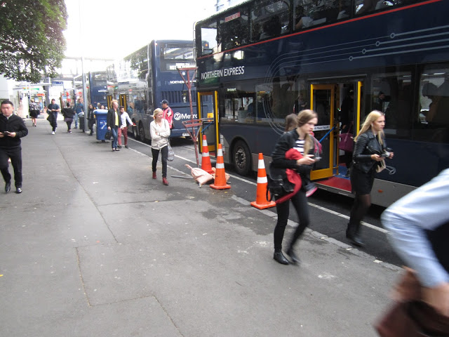
this posting which canvassed the dangers that had emerged with the sudden relocation of bus services that had been in Lower Queen Street, into Lower Albert Street. What this picture shows is the width of the pavement on the West edge of Lower Albert Street. These days its packed at am and pm peaks - including bus commuters and a good number of ferry users who prefer this route rather than through Lower Queen Street at present.
Auckland Council and Auckland Transport are currently planning how Lower Albert Street road space needs to be re-allocated to provide for pedestrian and commuter needs that can be anticipated there. One of the last Council meetings of the year received a presentation about it.
You can see this presentation and plan for yourself, in this agenda attachment
file, from page 36 on.
One of the issues that seemed to be absent in the consenting processes for the proposed new tower (cnr of Lower Albert and Custom Street) was the effect that traffic movements in and out of the proposed development would have on increased bus movements. However, as I have noted in previous postings about that,
here,
here and particularly
here, the tower consent application was non-notified and despite the bus conflict issues being identified, those effects were deemed minor and ARTA (Auckland's Public Transport Authority at the time), were not allowed to make submissions. The pigeons from that piece of Auckland CBD's planning history are coming home to roost now.
These conclusions make no mention of the conflicts that will exist between bus movements and the double width exit and entry off Lower Albert into the Precinct development, but they do highlight that there is some recognition of the need to sort this issue out. Belatedly. Public transport is usually the second last cab off the planning rank in Auckland (the last being public open space). At least its moving.
You'll need to click on this image to read the numbers. But the key numbers relate to changed pavement/bus waiting area widths between Quay St and Custom St. The west footpath is being widened from 4.5 metres to 7.1 metres. Same on the east side. This is a significant change, and will improve pedestrian amenity and safety.
This is a cross section from the report. Not sure why the east pavement width looks wider than the west pavement width - but the widths are the same according to the table. (NB: ironic that a width of 7.1 metres is deemed appopriate here, when the AT modelling for pedestrian flows through the downtown development between mid Lower Albert and Britomart are as high - if not higher than along Lower Albert - and will be accommodated in a laneway just over 5 metres wide.
I include this artist view of the finished cross section of Albert Street between Swanson and Wolfe. Looks like an attractive boulevard doesn't it. Let's hope AT's vision for this gets implemented on the street.


No comments:
Post a Comment